
Kordil EPS – Excavator Positioning System
Kordil EPS – Excavator Positioning System
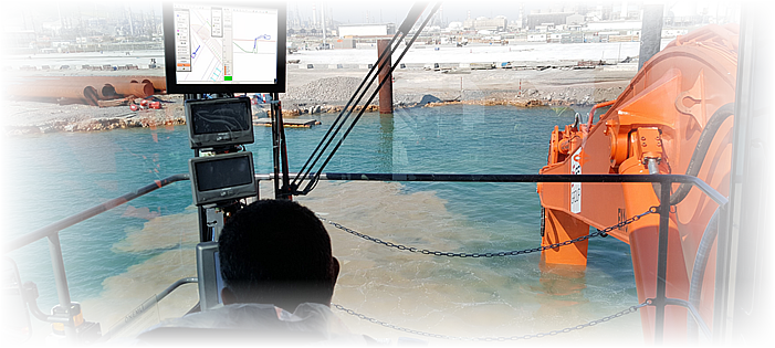
Kordil EPS – Excavator Positioning System
Kordil EPS is an excavator and dredger positioning system developed by Kordil. It provides real-time guidance to machine operators using GNSS sensors and onboard software with 2D, 3D, Difference View and profile displays. The system helps operators excavate, dredge, fill and grade to design levels without constant surveyor support. It supports productivity, reduces over-digging and helps save fuel and time while improving awareness near pipelines, structures and restricted areas.
Kordil EPS is used on excavators, dredgers, cranes and heavy construction machinery for marine, offshore and land projects.
Accuracy and technical specifications
| Horizontal accuracy | 0.20 m with RTK at 20 m total boom length |
|---|---|
| Vertical accuracy | ±5 cm at 20 m total boom length |
| Heading accuracy | 0.08° |
| Positioning mode | RTK GNSS standard; DGPS + Tide optional |
| Working temperature | −40°C to +85°C |
| Storage temperature | −40°C to +85°C |
| Power consumption | 200 W |
| Supply voltage | 12 / 24 VDC, depending on the onboard power source |
Main accessories
| GNSS system | Kordil H4 GNSS: multi-GNSS, multi-frequency and multi-constellation |
|---|---|
| Motion sensors | Kordil IMU, Version 3 |
| Sensor interface | Kordil ATK7 proprietary interface |
| Software | Kordil EPS proprietary software |
| Computer | Kordil OEM industrial computer, Windows 11 or later |
| Monitor | Kordil OEM 15-inch daylight monitor |
Optional accessories
| GNSS base station | Kordil H4 GNSS with built-in PC and NTRIP |
|---|---|
| UHF radio | Kordil UHF35 radio modems |
Applications
Kordil positioning systems support demanding excavation and heavy machinery operations, including:
- Dam and breakwater construction
- Flood and ice protection barriers
- Shore protection works and road construction
- Seabed levelling and access channel excavation
- Grading and land reclamation
- Offshore and underwater installations
- Mining operations and complex slope shaping
- Pipeline trenching and topographic surveying
Installation
Installation is carried out by Kordil’s qualified technical team to establish full system readiness. Limited on-site support and access arrangements from the customer may be required during installation.
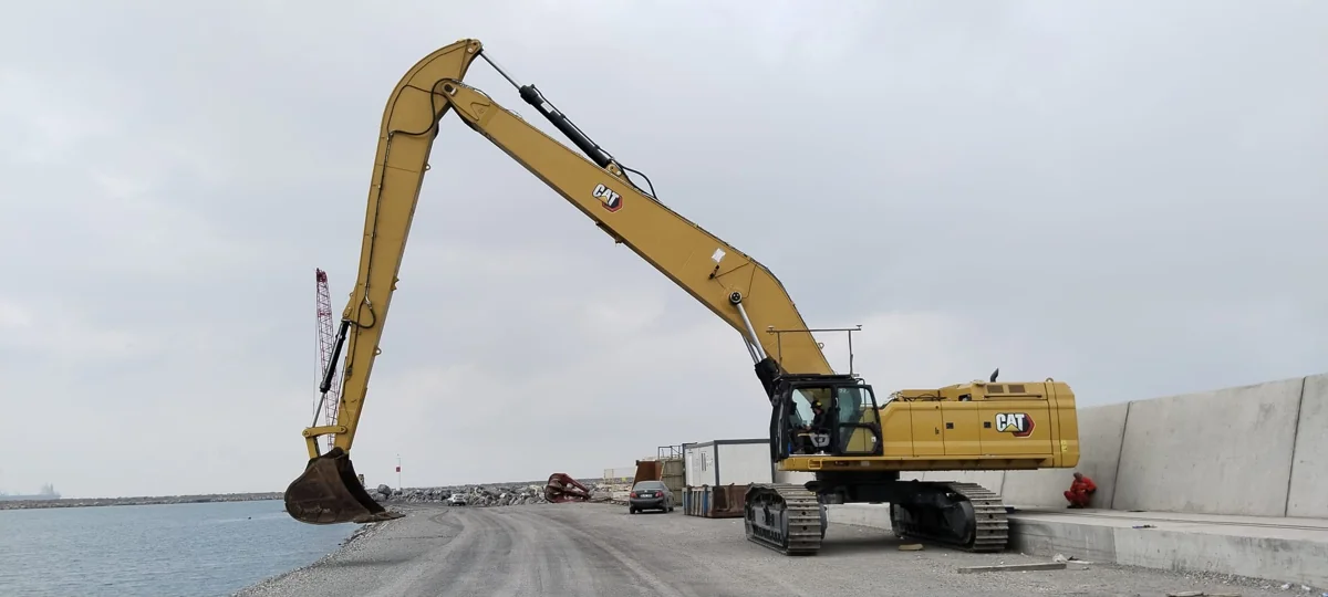
Long-reach excavator installation for shoreline and marine works.
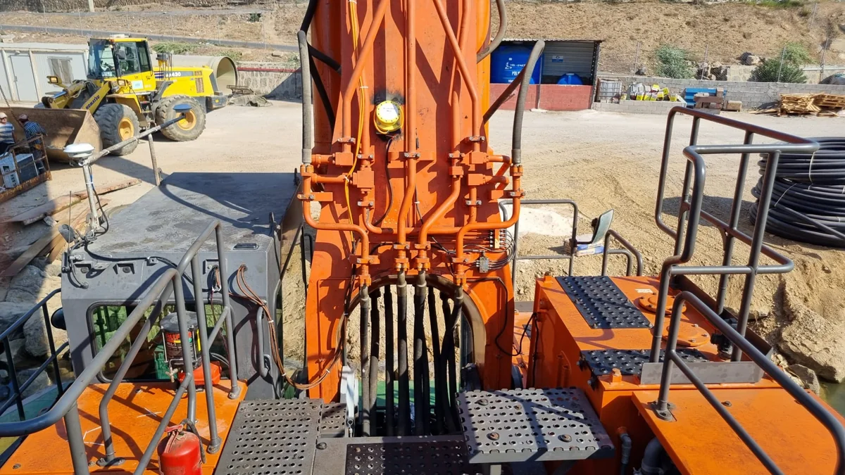
Excavator boom sensor and GNSS antenna installation.
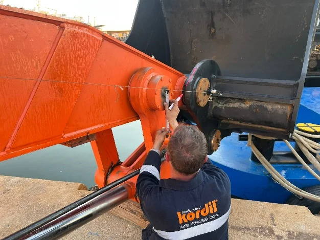
Kordil EPS sensor installation.
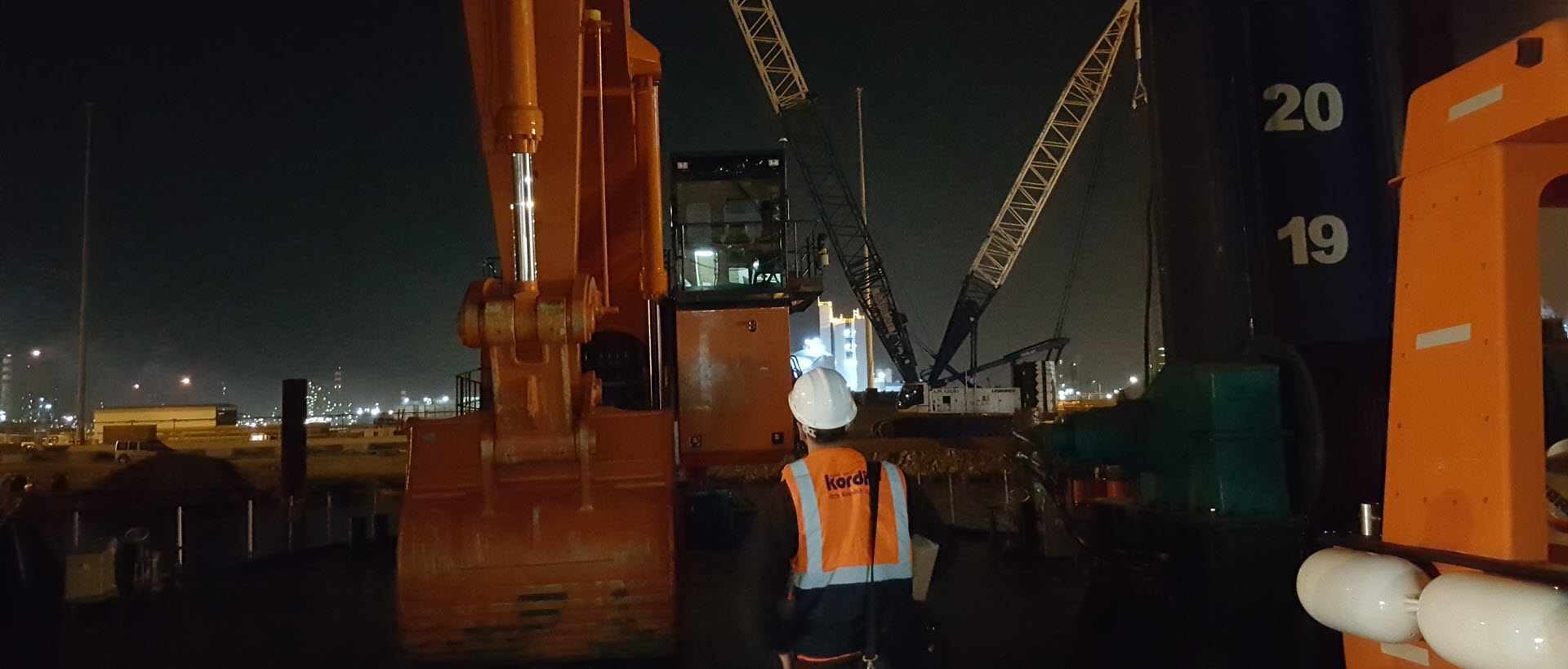
Kordil EPS installation work on marine excavation equipment.
Support and warranty
Kordil EPS is supplied with a one-year warranty and one year of reactive remote support. A full satisfaction warranty and lifetime free software updates are also provided.
- Senior-level training and remote technical assistance
- Responsive warranty service
- Free software maintenance and regular upgrades
- Lifetime software update support
- Remote updates and recalibration following machinery modifications, including bucket, boom, breaker or jackhammer configuration changes
Reasons to choose Kordil EPS
Kordil EPS brings monitoring, guidance, recording and progress visualization together in real time. Its functions include:
- Robust, durable, custom-engineered installation for continuous 24/7 operation
- Live survey data and dynamic profile updates
- Up to six design profiles plus one actual survey profile
- Onboard surveying through joystick or push-button XYZ logging
- Side, top, 3D and Difference View guidance screens
- Full sensor data recording for traceability and reporting
- GNSS correction through IP, NTRIP, CORS and L-Band services
- Optional radio corrections from a local base station
- Shock and vibration resistance for breakers and rock works
- KMZ, XYZ and DXF data compatibility
- Lambert, TM and UTM projection support
- IP69 waterproof sensor options; depth options up to 100 m
- Operator-friendly software and high-visibility displays for day and night use
- Remote screen monitoring over IP networks
- Configuration for land, marine, offshore and subsea operations
Authorized supervisors, engineers and project managers can monitor the operator display over IP networks to observe live operations, provide remote support and review progress.
Software screenshots and operator views
The Plan View offers three selectable display modes: the standard CAD model with colour marking, a 3D model view and the Difference Matrix. Operators can switch between these windows with a mouse click. The Profile View shows up to six design profiles together with one live survey profile.
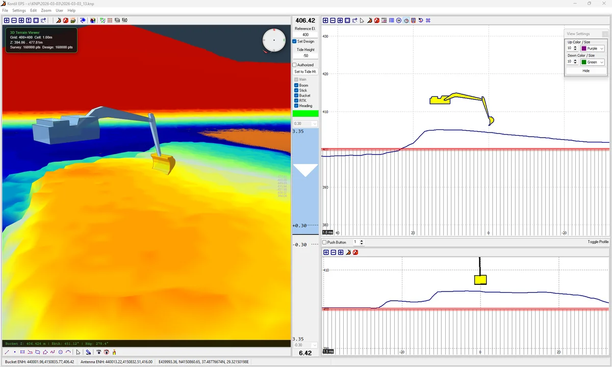
Kordil EPS 3D visualization and dynamically updated profile displays.
The Difference Matrix indicates cut and fill performance against design levels. White represents the target result, red indicates high areas and the blue spectrum indicates low areas. The colours are adjustable by the user. The CAD display, marking, difference information, design model and survey model update dynamically during work.
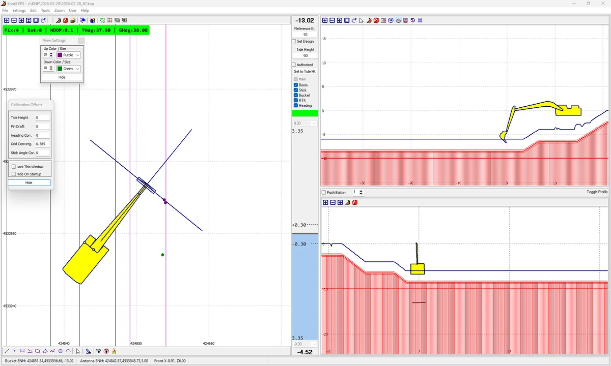
Plan and profile views for comparison with design and live survey information.
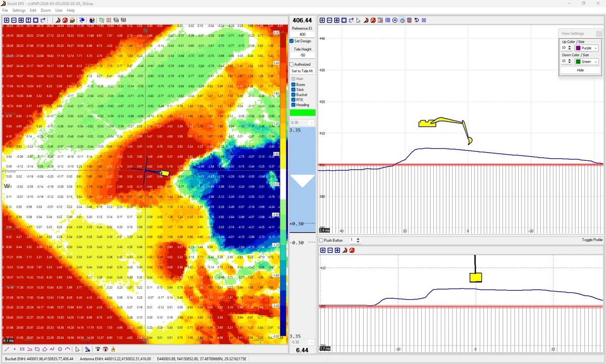
Difference Matrix: colour-coded comparison with design levels.
Calibration and one-time setup
Sensor calibration and shape definitions can be carried out automatically through the system interface with one click, with manual calculations and adjustments available when required. A simplified 3D model of the vessel or machine is generated from basic shapes, avoiding the need for advanced 3D modelling. Remote recalibration support is available after machinery configuration changes.
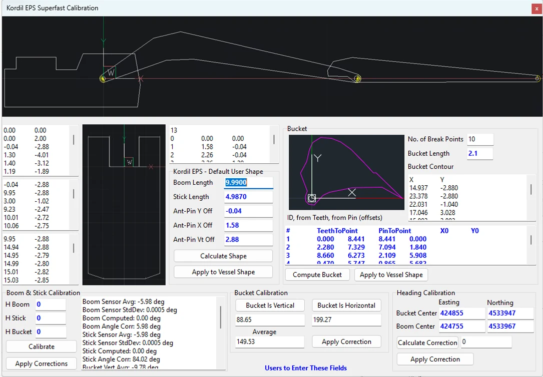
Machine geometry and calibration interface.
Selected installation and project pictures
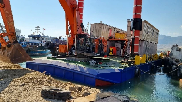
Kordil EPS marine dredging installation.
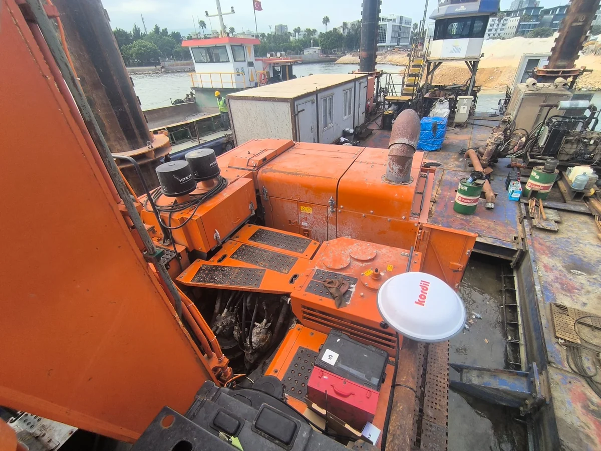
GNSS antenna installation in a marine working environment.
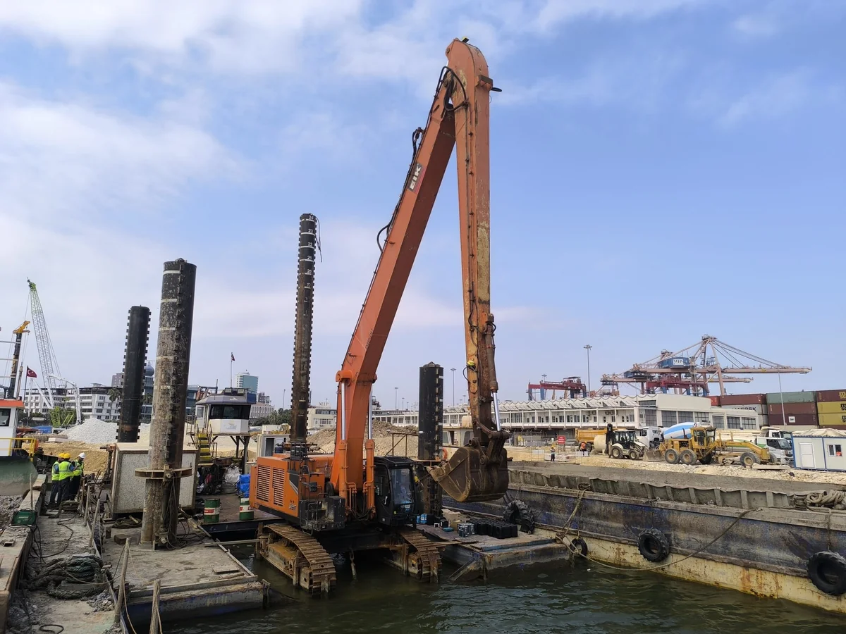
Excavator and floating platform used for harbour dredging.
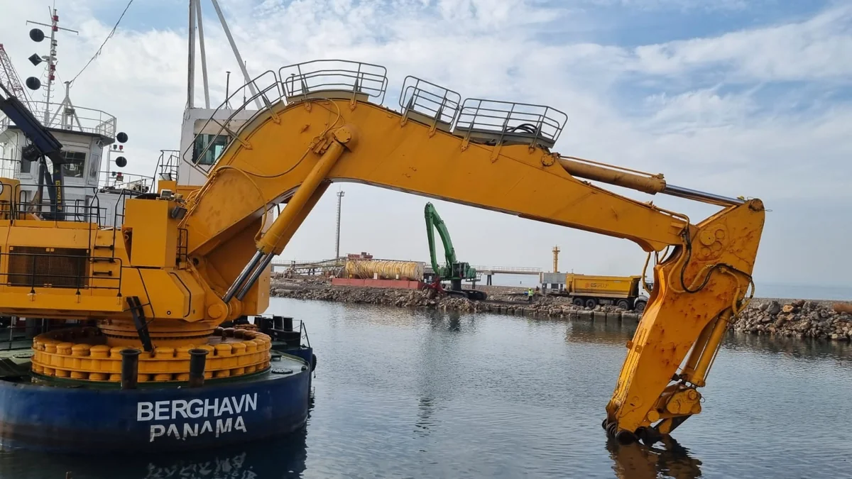
Marine excavation equipment working over water.
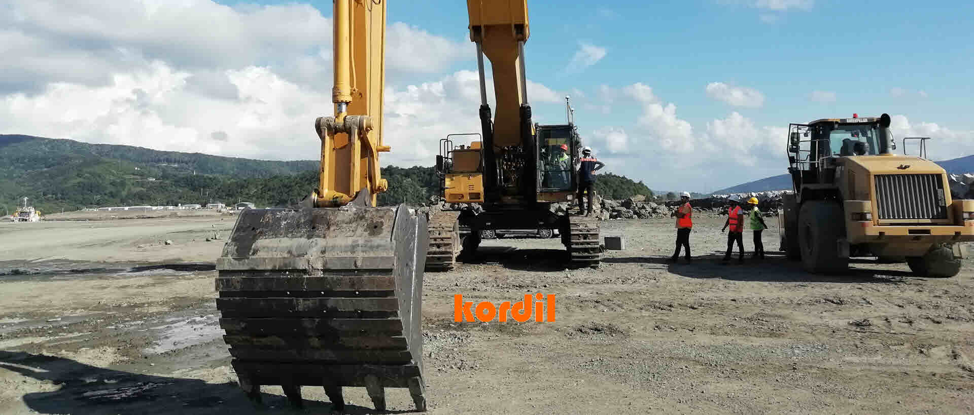
Kordil EPS excavator positioning for construction and earthworks.
About Kordil
Kordil designs and manufactures custom-engineered positioning systems for excavators, dozers, graders, cranes, wheeled and crawler machinery, ships, barges, offshore platforms, caisson foundations, pipelines, underwater robotic systems and unmanned surface vessels. Its solutions combine electromagnetic, mechanical and acoustic positioning technologies, with the majority of systems developed and manufactured in-house.
Proprietary software platforms are continuously enhanced to meet operational requirements. Kordil combines engineering expertise, field experience and an international network of specialists to support demanding construction and surveying projects.