
Offshore Surveying & Positioning
Offshore Surveying & Positioning Services; Hydrography, Oceanography, Magnetics, Sidescan, Subbottom, Sampling & Boring
Offshore Survey Services
Kordil provides integrated offshore surveys for ports, harbours, cable and pipeline routes, dredging and marine construction. Our services include:
- Multibeam and singlebeam bathymetry
- Oceanographic and meteorological measurements
- CHIRP sub-bottom profiling and UHRS seismic surveys
- Side-scan sonar, magnetometry and seabed debris mapping
- Marine UXO investigations for civil construction and archaeological surveys
- Geological sampling, gravity coring and sediment sampling
Our experienced teams combine survey vessels, specialised equipment and Kordil software with precise positioning, data processing, quality control and reporting to deliver practical, cost-effective survey solutions.
Bathymetry & Hydrography
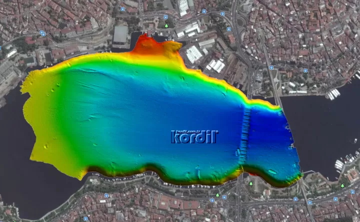
Multibeam and singlebeam surveys for navigation safety, ports, harbours, coastal engineering and offshore construction. Depth maps and seabed models support route planning, dredging and marine infrastructure projects.
Side-scan Sonar
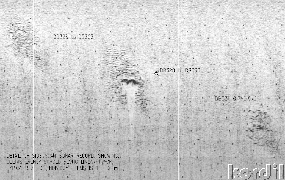
Acoustic imagery reveals seabed texture, objects and debris along survey routes and within construction areas. Side-scan data can be combined with multibeam, backscatter, water-column and magnetic measurements for integrated interpretation.
Marine UXO Surveys
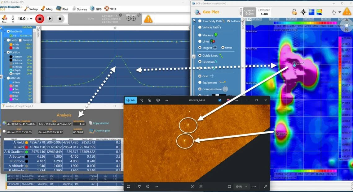
Integrated acoustic and magnetic investigations for civil construction projects, including dredging, cable routes, ports and offshore works. Target mapping, data interpretation and diving verification support project-specific UXO assessment.
Oceanography & Metocean

Measurements of currents, waves, tides, discharge and meteorological conditions, together with the physical, chemical and biological characteristics of seawater and inland waters. Monitoring supports the planning and operation of offshore projects.
Marine Magnetometry
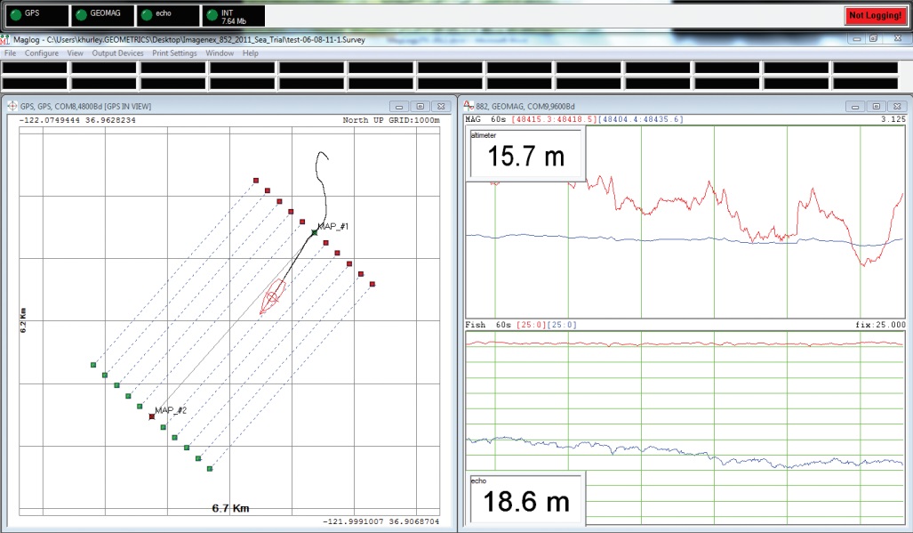
Marine magnetometer and gradiometer surveys locate magnetic anomalies associated with ferrous objects. Survey results support route investigations, debris mapping, marine archaeology and the assessment of targets requiring further inspection.
Survey Planning & Quality Control
We review site boundaries, water depth, expected targets and access before selecting the vessel, sensors and survey-line spacing. Coordinate and height references are agreed for comparison with drawings and earlier surveys.
During acquisition, positioning quality, sensor offsets and data coverage are checked together. Field observations and processing checks help identify gaps or uncertain results that may require repeat measurements. Survey conditions and checks are documented.
Sub-bottom Profiling
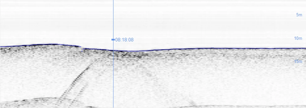
CHIRP sub-bottom profiling and ultra-high-resolution seismic surveys investigate sediment layers beneath the seabed. Applications include pipelines, cable routes, ports, harbours, offshore platforms and subsea installations.
Sampling & Coring
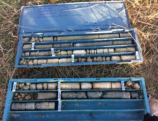
Geological investigations include gravity coring and surface sediment sampling, with boring selected to suit the project scope. Physical samples complement geophysical survey data and help characterise seabed and subsurface conditions.
Data Processing & Deliverables
Survey data are processed and interpreted for the decisions your project needs to support. Depending on the scope, deliverables can include bathymetric charts, seabed models, acoustic mosaics, interpreted sediment profiles, magnetic anomaly maps and a coordinated register of targets or crossings.
Coordinate systems, vertical datums and file formats are agreed before fieldwork. CAD and GIS data, sections and technical reports support design, construction and comparison with previous surveys.
Reports state the methods, data quality and interpretation limits, with any need for further investigation.
Tell us your project location, survey area, water depth and required schedule so we can propose a suitable survey scope.
Request a Quotation