
Distribution of Surveying Instrumentation & Equipment
Explore Kordil’s range of hydrographic survey equipment, underwater positioning systems, geophysical instruments and survey software. Select a brand to compare products, review technical specifications and find equipment for your marine or land survey workflow.

NORBIT
Multibeam sonar and integrated survey systems for detailed seabed mapping. Explore WINGHEAD and WBMS solutions, together with complementary LiDAR and sub-bottom profiling equipment.
Applied Acoustics
USBL positioning, acoustic beacons and releases for underwater tracking and recovery. The range also includes seismic sources, survey streamers and submersible GNSS equipment.

Innomar
Parametric sub-bottom profilers for high-resolution sediment investigation. Compare systems for shallow and deep water, including compact installations for unmanned surface vessels and remotely operated vehicles.
EdgeTech
Sub-bottom profiler systems for investigating sediment layers and buried features beneath the seabed. High-resolution acoustic profiling supports marine geophysical surveys, engineering site investigations and sediment studies.
Marine Magnetics
Marine magnetometers and gradiometers for detecting ferrous objects beneath or on the seabed. Applications include geophysical surveys, wreck investigation, archaeology and unexploded ordnance searches.

GEM Systems
Potassium, Overhauser and proton magnetometers for geophysical investigation. Explore magnetic survey equipment for geological mapping, archaeological studies and detection of buried ferrous targets.

Klein
Side-scan sonar systems for detailed seabed imagery and underwater target detection. Suitable applications include hydrographic survey support, search operations, infrastructure inspection and marine research.
Ping DSP
Three-dimensional side-scan sonar and swath bathymetry for shallow-water surveys. Combine seabed imagery and depth information to interpret underwater features and investigate targets.
Baywei
Compact multibeam sonar equipment for bathymetric mapping. Explore survey configurations suited to small vessels and unmanned surface platforms where installation space and payload matter.
Deep Vision
Digital side-scan sonar for seabed imaging, underwater search and survey work. Explore equipment for identifying bottom features and producing interpretable sonar imagery from towed surveys.

LC Sonar
Side-scan sonar equipment for seafloor imaging and underwater target detection. Explore practical survey solutions for examining seabed features and supporting marine search and inspection work.

Geometrics
Geophysical survey instruments and marine magnetometers for investigating subsurface conditions. Magnetic measurements support detection of ferrous objects, geological interpretation and marine engineering investigations.
AML Oceanographic
Oceanographic sensors and profiling instruments for measuring water-column conditions. Sound-velocity and conductivity, temperature and depth measurements support hydrographic corrections and environmental observations.
Obscape
Environmental monitoring systems combining field sensors, remote communications and online data access. Explore equipment for observing water conditions and supporting coastal, hydrological and marine monitoring projects.

LinkQuest
Underwater acoustic positioning, communications and current-measurement equipment. Explore systems supporting subsea tracking, data exchange and water-current observations for marine survey and research operations.

Ohmex
Single-beam echo sounders for shallow-water bathymetry, including SonarMite solutions. Compact equipment supports depth surveys from small boats and integration with positioning systems.
Hemisphere GNSS
GNSS positioning and heading solutions for marine and land applications. Explore receivers and antennas for survey integration, vessel orientation and precise real-time positioning workflows.
ComNav Marine
Marine navigation and positioning equipment for vessel guidance and survey integration. Explore solutions that support reliable heading and navigation information during marine operations.

Tritex NDT
Ultrasonic thickness measurement equipment for non-destructive inspection. Explore tools for checking metal thickness and supporting condition assessment of marine structures, vessels and industrial assets.

Chesapeake Technology
SonarWiz software for sonar acquisition, processing and interpretation. Work with side-scan, bathymetric, sub-bottom and magnetic survey data to develop clear maps and survey deliverables.

Kordil
Survey software and positioning systems for marine construction and engineering. Explore Navigation Pro, excavator and crane positioning, Subbottom Processing, Bathymetry Studio, Geodesy Tools and Port Sharing.
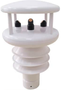
RIKA
Ultrasonic weather instruments for wind and environmental monitoring: RK900-10, RK900-11 and RK900-12.
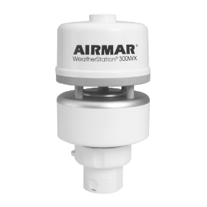
Airmar
Airmar 300WX-IP67 marine weather station for wind, air temperature and pressure measurements, with GNSS, heading and motion data for true wind calculation.