Marine UXO & Seabed Obstruction Surveys with Diving Verification
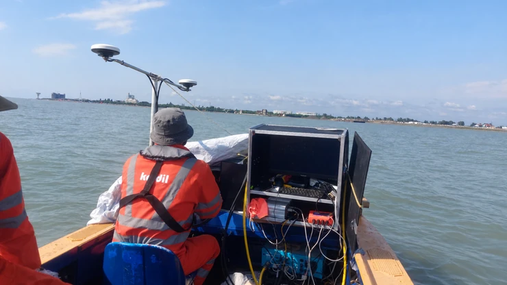
Complete Marine UXO surveys, diving verification and integrated offshore geophysical investigation. This work requires highly experienced personnel and advanced data processing capabilities. Kordil brings it all together in one place. Our hybrid survey approach combines magnetometry or gradiometry, sub-bottom profiling, side-scan sonar and multibeam bathymetry, with backscatter analysis where appropriate.
Kordil provides marine UXO survey services exclusively for civil construction, including ports, dredging, offshore works, and cable and pipeline projects. We combine multibeam bathymetry, side-scan sonar, sub-bottom profiling and magnetic surveys to locate exposed and buried targets. Precise positioning and integrated data processing support reliable target mapping. Kordil Subbottom Processing software assists with burial-depth assessment, while diving verification and handheld gradiometers support target investigation. Results are presented in clear maps, target registers and reports to support construction planning and engineering decisions.
Request a Marine UXO Quotation
Tell us your project location, survey area and schedule so we can prepare a project-specific survey proposal.
Complete Marine UXO Survey
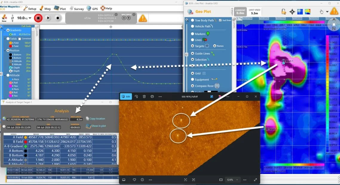
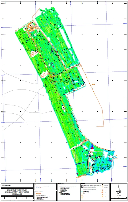
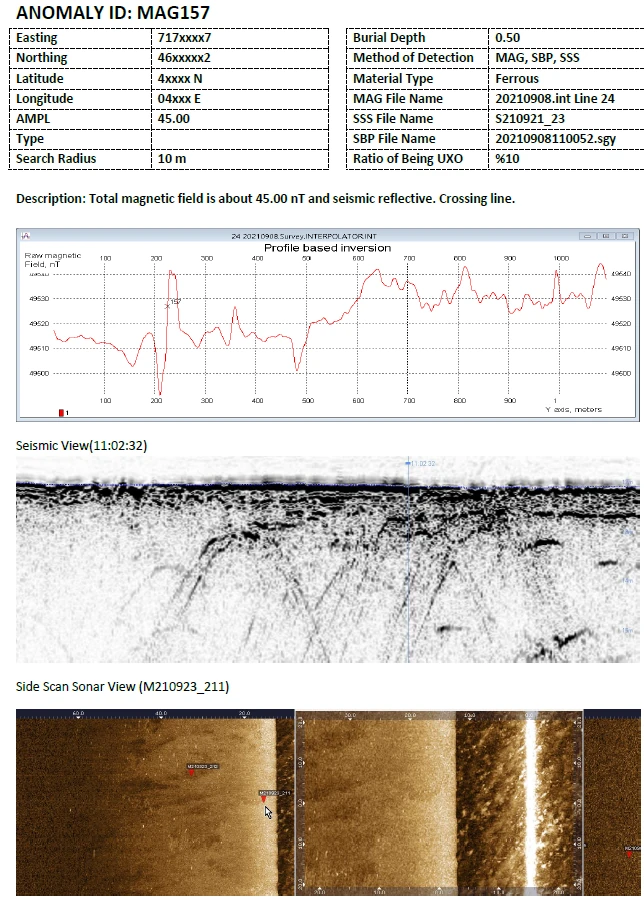
Kordil’s proprietary Marine UXO survey data and integrated interpretation. Upper left: magnetic profiles; lower left: target statistics; right: mapped gradient anomalies; inset: side-scan sonar contacts correlated with the magnetic targets.
Kordil brings together survey planning, offshore data acquisition, processing, hybrid interpretation and target verification support in one coordinated Marine UXO survey workflow. The agreed scope connects wide-area investigation with a prioritised target register and, where required, diving verification of selected anomalies.
Historical military activity can leave unexploded munitions in marine environments. Construction, dredging, anchoring and seabed intervention therefore require a project-specific understanding of potential hazards. Geophysical investigation helps project teams identify areas and targets for specialist review before intrusive work begins.
Survey scope is agreed around the project footprint, available historical information, water depth, seabed conditions and intended works. Kordil's survey results support the wider UXO risk-management process; they do not replace a specialist risk assessment or constitute an explosive ordnance clearance certificate.
Integrated survey methods
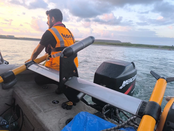
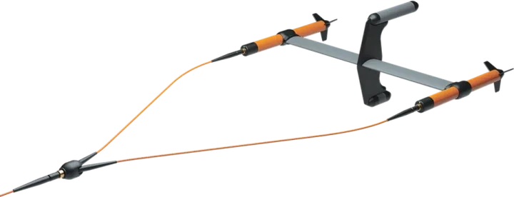
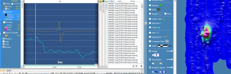
Marine magnetometry and gradiometry: mapping disturbances in the magnetic field associated with ferrous objects, including objects that may be buried beneath the seabed.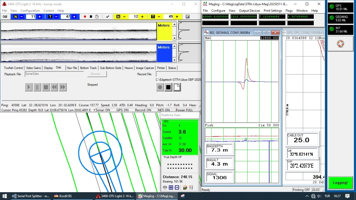
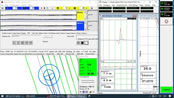
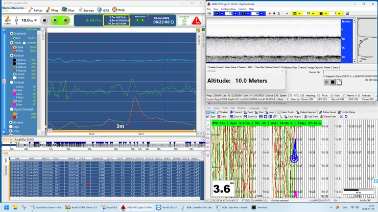
Simultaneous acoustic and magnetic acquisition: sub-bottom records, magnetometer response and survey navigation shown together.
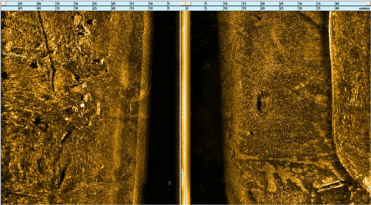
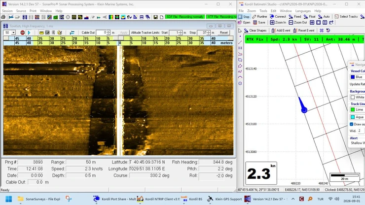
Side-scan sonar: imaging exposed objects, debris, seabed textures and acoustic shadows to support target interpretation.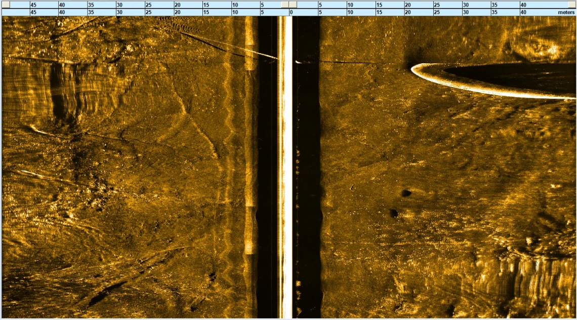
Side-scan sonar record showing seabed texture, distinct contacts and their acoustic shadows.
Multibeam bathymetry: providing seabed topography and spatial context for survey planning, interpretation and subsequent investigation.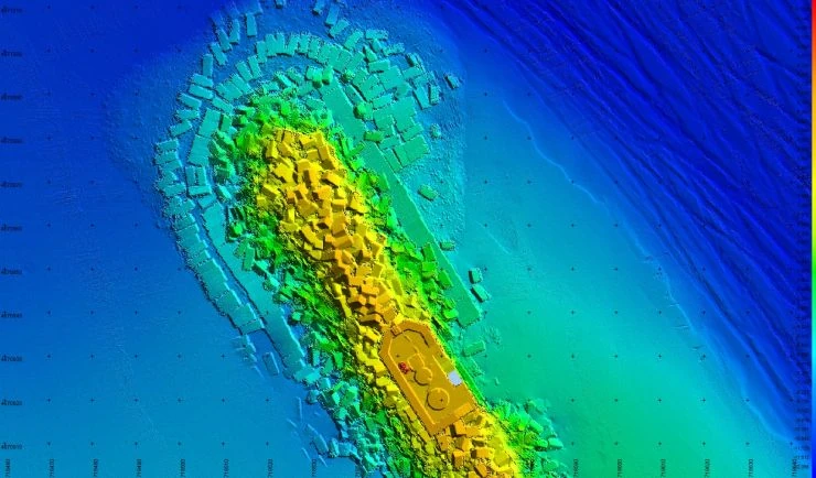
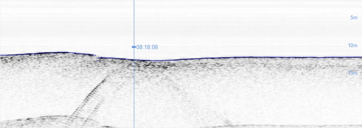
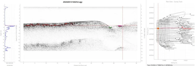
Sub-bottom profiling survey: investigating sediment layers and buried acoustic features below the seabed, supporting burial-depth assessment and correlation with magnetic and sonar targets where the data allow.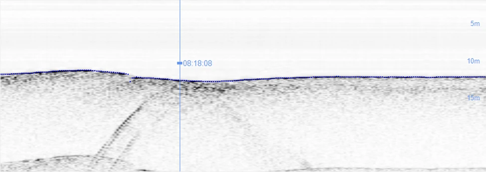
Sub-bottom profile showing the seabed reflector and deeper acoustic returns associated with a UXO-like anomaly, used to assess burial depth.
Positioning and data integration: bringing sensor observations into an agreed coordinate reference system, with navigation and sensor offsets considered during processing.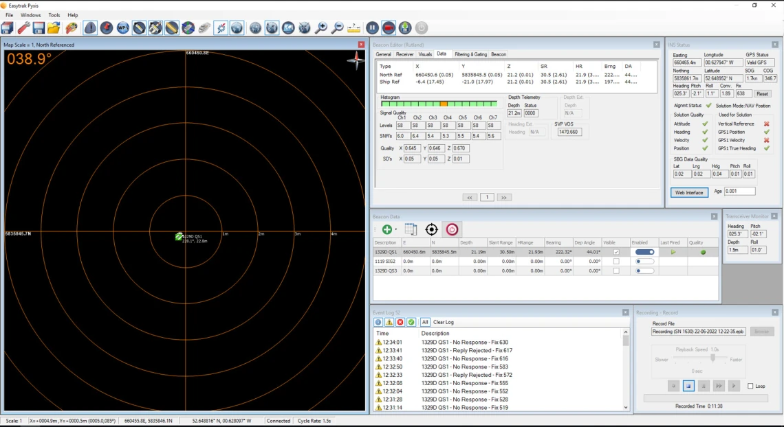
Easytrak Pyxis USBL positioning display showing a tracked underwater target and navigation quality information.
Combining these datasets helps distinguish isolated targets from wider debris fields and understand where magnetic and acoustic observations coincide. Detection performance depends on target properties, burial, sensor geometry, environmental conditions and survey coverage. No single sensor can identify every potential hazard.
Top-Grade Instrumentation
- Integrated multibeam and side-scan sonar: Combine precise seabed depth measurements with detailed sonar imagery. Shared positioning and motion data help locate targets accurately.
- High-resolution towed side-scan sonar: Provides detailed images of seabed objects and their acoustic shadows.
- CHIRP sub-bottom profilers: Reveal sediment layers and buried features, supporting burial-depth assessment.
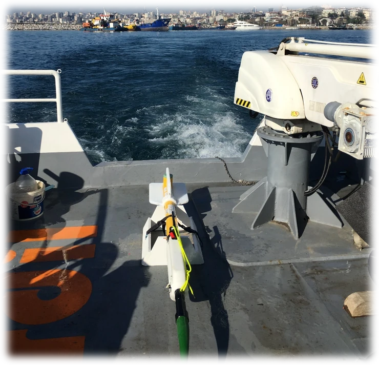
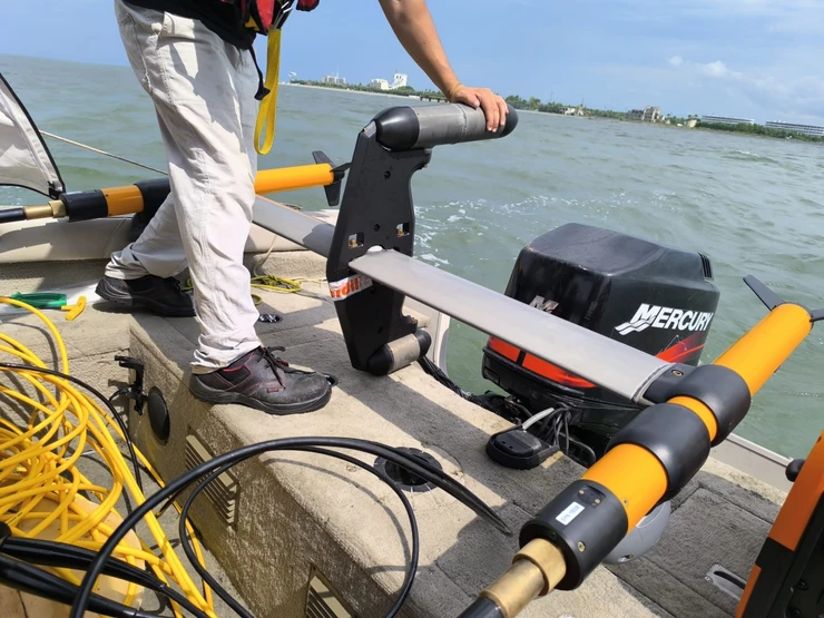
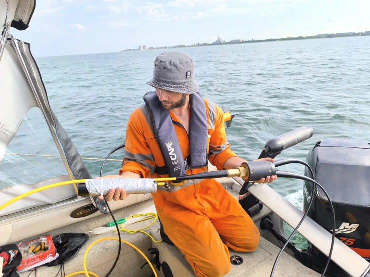
- Marine magnetometers and paired-sensor gradiometers: Detect magnetic anomalies associated with ferrous objects, including those buried beneath the seabed.
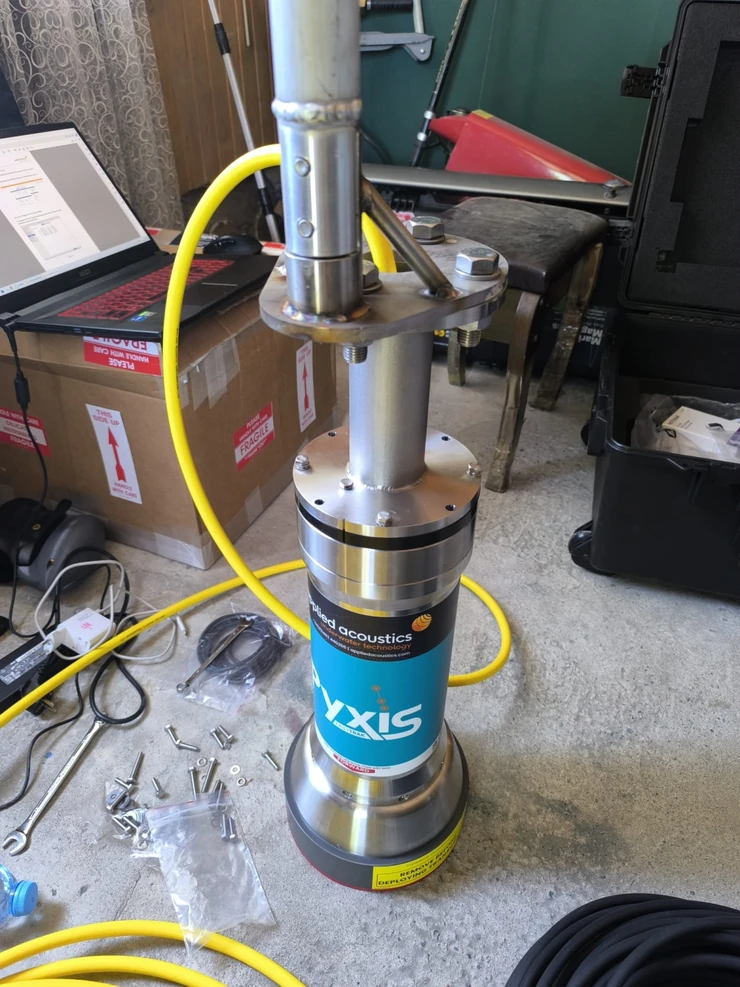
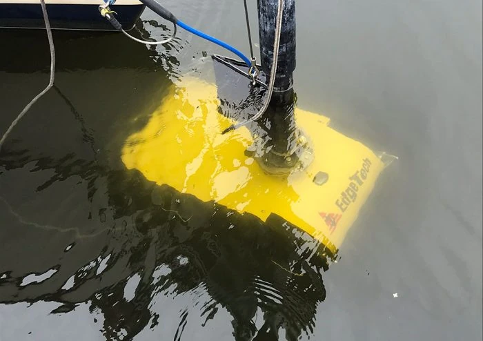
- Pre-calibrated USBL with integrated motion sensors: Supports accurate underwater positioning of survey sensors and targets.
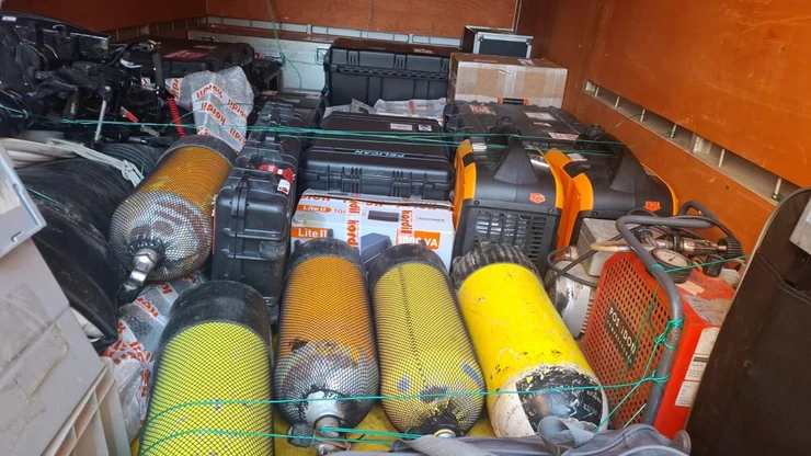
- Handheld gradiometers: Assist divers with local target investigation and verification.
Together, these instruments provide complementary acoustic, magnetic and positioning data for detecting, locating and interpreting exposed and buried targets.
Top-Quality Survey and Precision Positioning
Kordil combines precise GNSS positioning with pre-calibrated USBL underwater positioning and an integrated IMU to position survey sensors and underwater targets accurately. Satellite correction services support RTK-grade precision for nearshore and offshore surveys, where coverage and operating conditions allow.
Kordil Geodesy Tools (KGT) enables precise coordinate system implementation, coordinate transformation and transformation parameter estimation, keeping all survey data in a consistent reference system.
We check sensor offsets, timing, positioning accuracy and survey coverage. Clear target coordinates and documented processing support diving verification, engineering review and repeat inspections.
Sub-bottom profiling and burial-depth assessment
Sub-bottom profiling complements seabed imaging by investigating sediment layers and acoustic reflectors beneath the seabed. It can help assess whether a target or associated feature is buried and support estimation of its depth below the seabed where a clear response is resolved. Results are interpreted alongside magnetometry or gradiometry, side-scan sonar and multibeam data.
Kordil Subbottom Processing software supports the processing and interpretation of sub-bottom survey records for burial-depth detection and assessment. The workflow relates interpreted subsurface features to the seabed and the project survey data, supporting investigation of buried objects and engineering features. Burial-depth estimates depend on data resolution, sediment conditions, sound-velocity assumptions and the clarity of the target response; they are reported with relevant limitations.
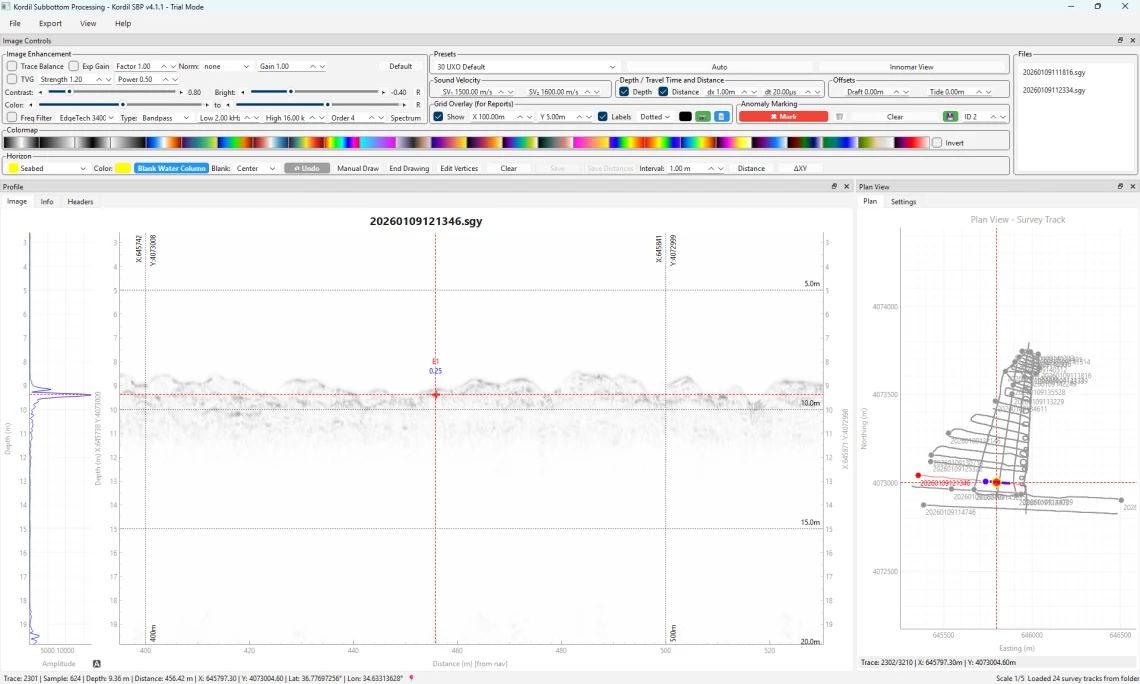
Download the Kordil Subbottom Processing datasheet (PDF).
Diving Verification and Diver Support
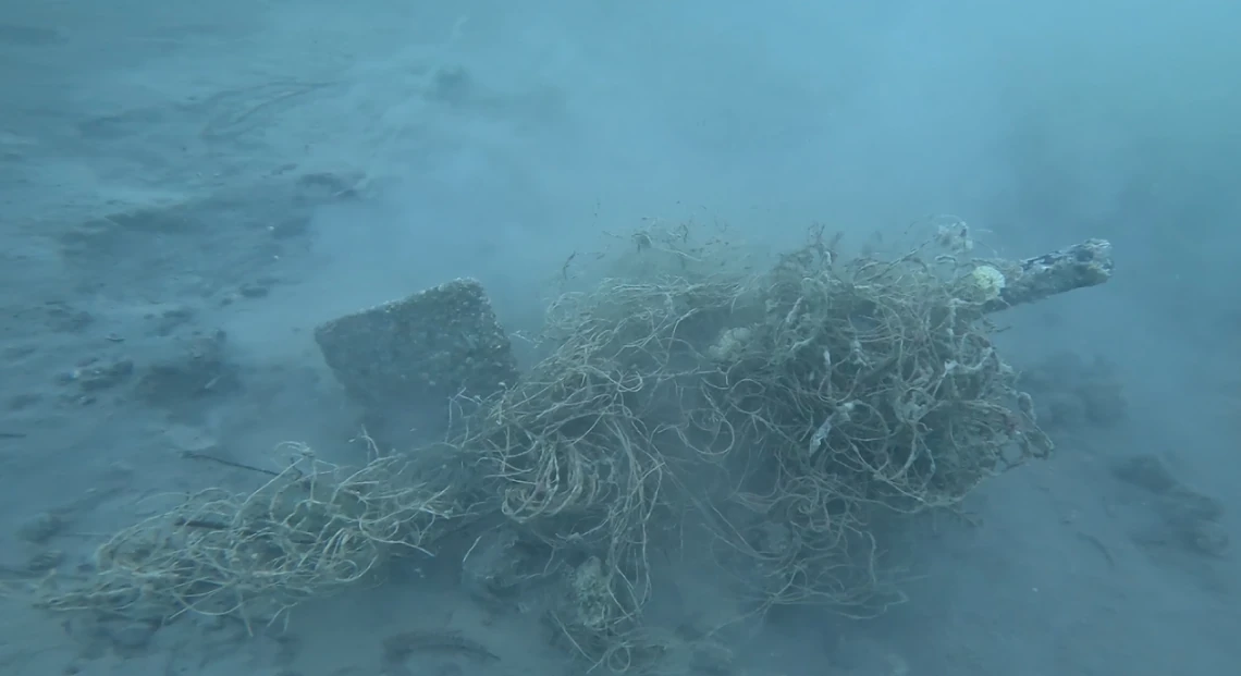
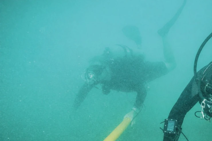
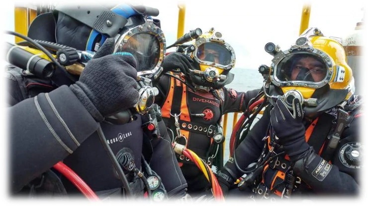
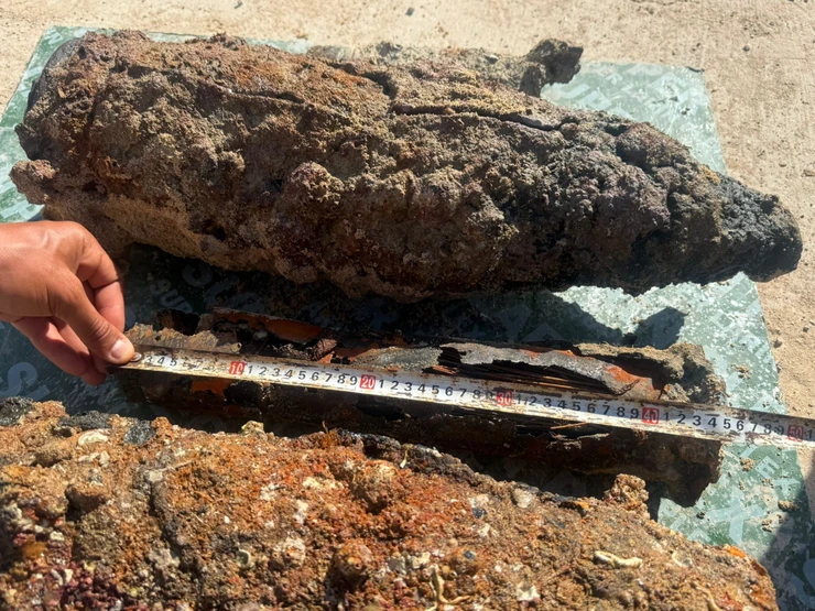
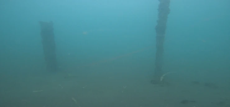
Diving verification connects geophysical targets with direct underwater observations where the project-specific investigation plan permits. Selected targets are relocated using their survey coordinates and supporting imagery, then documented through diver observations, photographs or video and an updated target record. The results are fed back into the survey interpretation so that confirmed observations and unresolved targets remain clearly distinguished.
Handheld Gradiometers for Divers
Survey maps and target registers support dive planning and the relocation of selected targets. Kordil can support diving teams with georeferenced target information, surface survey coordination and follow-up measurements. A handheld gradiometer, such as Marine Magnetics Argos, assists with localising ferrous anomalies during an authorised underwater investigation, including when visibility is poor or the object is not immediately visible.
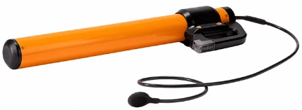
Diver observations can be correlated with the original magnetic and acoustic findings and added to the target record. Any approach to a suspected munition must follow the project-specific UXO specialist's procedures. Geophysical survey and diver support are distinct from explosive ordnance disposal.
Port and harbour inspections
Integrated surveys are also applicable to port and harbour inspections, including berths, approach channels, turning basins, quay surroundings and dredging footprints. Multibeam bathymetry maps seabed levels and morphology; side-scan sonar images exposed objects; magnetometry or gradiometry identifies ferrous anomalies; and sub-bottom profiling investigates buried features where conditions permit.
Kordil Subbottom Processing contributes to interpreting subsurface records and assessing burial depth in these inspection programmes. Combined results support maintenance planning, dredging preparation, assessment of seabed obstructions and selection of targets for further inspection. Existing harbour infrastructure can influence magnetic measurements, so interpretation takes account of the local setting and available asset information.
Data Processing and Hybrid Interpretation
Hybrid interpretation combines complementary datasets rather than relying on one sensor response. Magnetic anomalies are compared with side-scan sonar contacts, multibeam seabed morphology, sub-bottom reflectors and positioning records. Where diving verification is available, these observations provide an additional evidence layer for the same target.
Processing brings the datasets into a consistent spatial reference and includes navigation review, quality checks and appropriate corrections. Kordil Subbottom Processing supports interpretation of sediment profiles and burial depth where the acoustic evidence allows. The final assessment preserves the source records, target identifiers and interpretation confidence so that clients can review how each finding was reached.
Traceable Target Register
Our work covers survey preparation, field data acquisition, processing, quality control and interpretation. Survey coverage, navigation quality, noise and data gaps are reviewed so that limitations remain visible in the final assessment. Targets are assigned consistent identifiers and correlated across the available datasets.
The interpretation records what the data show and where uncertainty remains. Magnetic anomalies may also originate from cables, scrap metal, wreckage or other infrastructure. Acoustic appearance alone cannot establish whether an object contains explosives. Where required, the findings are passed to competent UXO specialists for further assessment and an authorised investigation plan.
Typical project applications
- Offshore cable and pipeline routes and landfall approaches
- Port development, harbour works and dredging areas
- Offshore wind and other marine energy developments
- Foundation, piling, drilling and anchoring footprints
- Pre-construction debris surveys and follow-up target relocation
Survey deliverables
Deliverables are agreed to suit the client's engineering and GIS workflow and may include georeferenced anomaly maps, side-scan sonar mosaics, bathymetric context, survey coverage plots and a target register. The register can include target coordinates, supporting imagery, magnetic observations, interpretation notes and recommended priorities for specialist review. A technical report documents the equipment, methods, processing, quality checks and survey limitations.
Request a Marine UXO Survey Quotation
Planning a marine UXO survey, diving verification or port and harbour inspection? Send Kordil your project details to discuss the scope, instrumentation, deliverables and schedule.
- Project location and survey boundary or route
- Water depths, site conditions and planned seabed works
- Required survey methods, diving verification and reporting needs
- Preferred mobilisation dates and available historical or geophysical information
Request a Marine UXO Quotation
Alternatively, email sales@kordil.com with your project information or call +90 (216) 344-6835.