Geodesy & Engineering Surveying
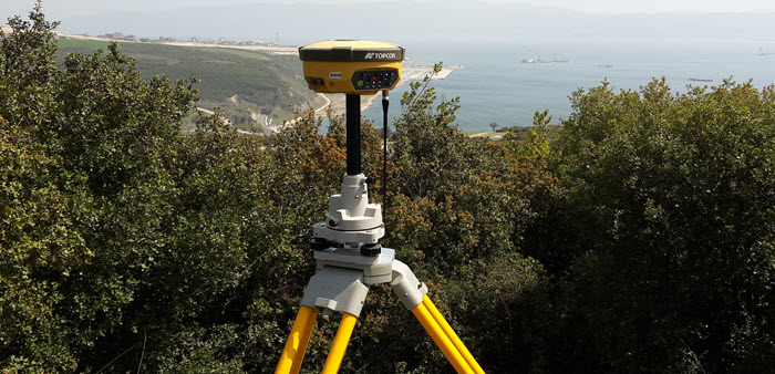
Kordil utilizes advanced geodesy for establishing geodetic datum, geodetic survey network, geoid model, and real time kinematics geodetic GNSS networks from size of a construction yard to a country territory. Science of geodesy has been extensively used and implemented by Kordil in most of national and international projects. Kordil has a proprietary software package for geodetic engineering for computation, processing and real time monitoring of geodetic survey data.
- Establishing and surveying geodetic network tied in national datum
- Establishing site control network in local survey convertible to national datum
- Realtime monitoring of deformations, settlements, deflections and even tectonic movements
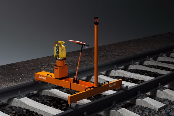
- Extracting geometry of railway lines using Kordil's proprietary railway survey machine
- Realtime deformation monitoring and adopting early warning systems
- Virtual GNSS network for construction sites and for government
- Creation of geoidal model
- Creation of local ellipsoid
- Creation of datum transormation parameters
Triangulated Geodetic Network
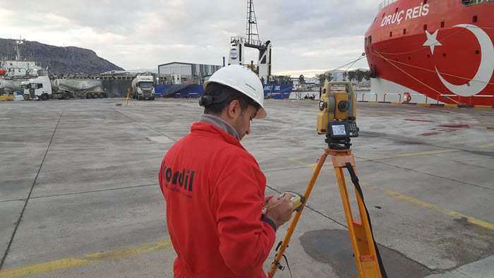
We establish and carry out all triangulation surveys at national and international standards related to country’s survey network. We set up control points to be used in project sites by using high level priority survey benchmarks that require high accuracy. These survey benchmarks can also be on construction sites or in very remote corners. All calculations are made by Kordil, and the highest accuracy is ensured and guaranteed.
Submillimeter Accurate Deformation Monitoring Systems
We have deformation solutions with very high repeatability to monitor deformations. To monitor construction sites, earthquakes and natural disaster zones, we monitor possible unwanted movements by installing or using motorized or real-time systems that are suitable for 24/7 operation. The monitored structures or objects can be a mountain, a city, a route or a building or a crack. The data from integrated systems are collected, processed, and prepared in a single point and transformed into a form that is required.
Kordil has proprietary deformation monitoring software for monitoring, processing and early warning.
Industrial Surveying Systems
We carry out surveys that require very high accuracy in the factories and industrial facilities, such as leveling, aligning and positioning in order to erect heavy machinery and equipment. Similarly, we have our own products and systems for measuring slope, distance, and position of railways in real time.
Engineering Survey
Non-routine surveys are one of Kordil's main fields of activity.
- Observing and recording tectonic movements
- Establishing and operating early warning systems for landslides
- Terrestrial and GNSS based deformation survey and early warning system
- Total-station based deformation monitoring and early warning systems
- Simultaneous surveying of both land and sea sides with an integrated laser scanner and multibeam system
- Cliff / canyon mapping
- Establishing a multisensor network for three-dimensional dynamic motion tracking
- Tunnel deformation survey
- Monitoring systems of underwater settlement and displacement
- Periodic maintenance surveys and inspections of pipelines
- Periodic maintenance survey of railroad systems
- Speed tracking systems on highways
- City modeling
Generation of Offshore Geoid
Kordil has the capacity and technical background to create a highly accurate geoid model for use in offshore construction activities and projects. The surveying techniques that are used combined with the industry standard geodetic methods and offshore surveying experiences to achieve a reliable and centimeter level.
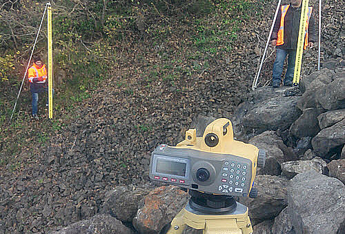
High Precision Levelling
Turkey established a vertical network and carry out leveling at very high accuracy (2 to 10 per millimeter per kilometer) for the tightening of 1st and 2nd-degree triangulation networks and monitoring of settlements. They are also used to monitor deformations of engineering structures such as tunnels, dams, bridges and tunnels.
Automated Measurement of Railway Geometry
Real-time measurement and recording systems have been developed and used for the real-time survey of rail geometry, the design of old rail systems, and for quality control.