
Kordil™
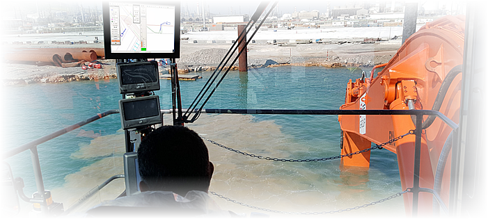
Kordil EPS (Excavator Positioning System) is an integrated custom fitted positioning system for excavators and dredgers providing precision position information on a screen in 3D but in 2D form top and side view. Operator can see design, actual survey profiles in real-time. Survey profile is updated as dredged or as filled up. In addition, on completion of a part of work, excavator can perform an independent survey over the work area for surveyors to report. With Kordil EPS, work performance drastically improves twice more than an excavator without Kordil EPS or similar because of no time-consuming interruption by surveyors, and operation keeps going without any external assistance. Kordil EPS also provides safety improvement when performing near and on hot/live lines or structures. As it is difficult to guide the heavy machinery from the outside and requires too much efforts, the EPS brings serious performance and safe work.
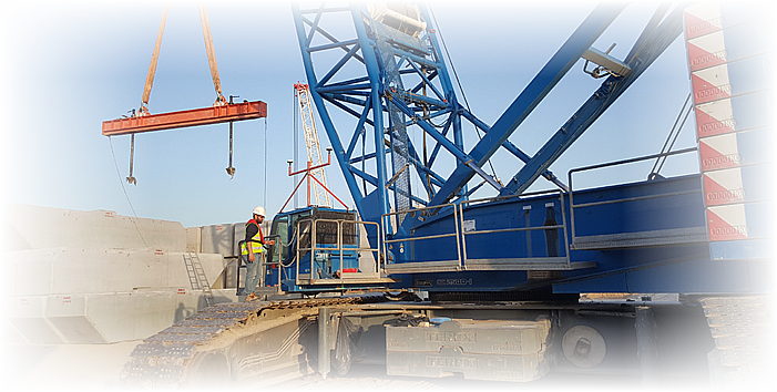
Kordil CPS - Crane Positioning System: Kordil CPS is a crane positioning system using smart sensor technologies and easy-to-use real-time monitoring software which was evolved through operators’ feedbacks. Although system works in 3D at background it is presented to the operator in 2D and simplified form. All information required by operator for filling, assembly and placement works are displayed on the screen in real time with very user-friendly interface. The length of rope released from the drum is measured precisely to achieve in a centimeter positioning accuracy.
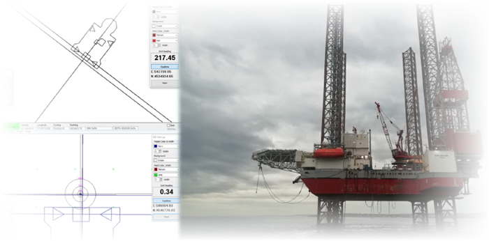
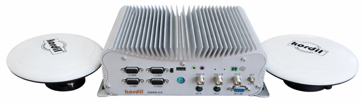
Kordil Navigation Pro is a multipurpose precision positioning system designed for positioning of any kinds of moving objects such as ships, vessels, barges, cars and trucks. Supports NMEA positioning and heading messages. It allows integration of other types of sensors such as inclinometers for vertical positioning and tide gauges and supports a second GPS device to calculate heading out of positions when gyroscope is not available
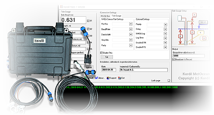
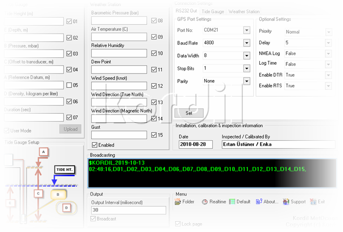
Kordil TG05 Tide Gauge is a high precision & high accuracy water level monitoring and logging system. With low power consumption, easy installation and compact size enables Kordil TG05 usage in a lot of different application areas. It can be installed in areas or structures like sea, dam, natural and artificial lakes, rivers, water tanks etc. User can see the retrieved tide information on Kordil MetOcean software or in the log file where $KORDIL messages from TG05 Tide Gauge are saved.
Kordil Bathymetry Studio (KBS) is a bathymetric survey data collection and processing software package for single beam. It provides the Surveyor with all the tools needed to design their survey, collect data, process it, and generate final products. As the bathymetric survey is a combination of complex systems requires many processing tools, KBS organise and presents it in a simple way to complete your job such as navigation, data storage, coordinate / datum transforms, data exchange with CAD software, data transfer via Bluetooth or RS232 COM port and many other processes.
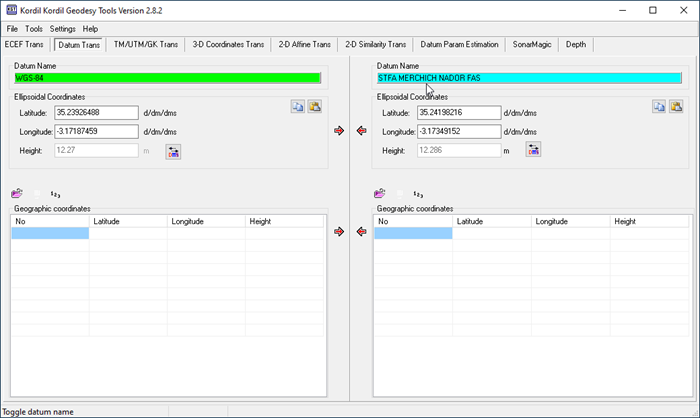
A powerful and reliable coordinate processing, transformation, and transformation parameters estimation software for surveyors. Easy to use interface and intelligent file reading makes it a handy tool for the surveyors
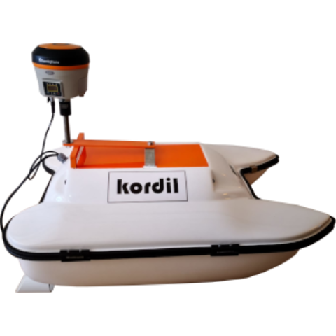
Kordil produce remote controlled survey boats for customer bathymetric survey requirements incorporating a single beam echo sounder, GNSS positioning. With high bandwidth radio link allows the operator to see precise bathymetric survey results in real time. It is useful for tough and unsafe work environments include mines, sewage treatment plants, contaminated lakes, harbours and rivers. It is manufactured from high quality marine materials and components and easily disassembles for transport and shipping.
Meteorological and oceanographic measurements are combined on integrated platforms to obtain multiple data from a single point. For this reason, it was named Metocean. The Kordil Metocean system brings a high-level oceanographic system and a high-level meteorological system together on a single platform which enables to combine, record and sent to a remote location in real time at desired intervals. This platform can be anywhere including a buoy at the middle of ocean, at your ship roof or work site.
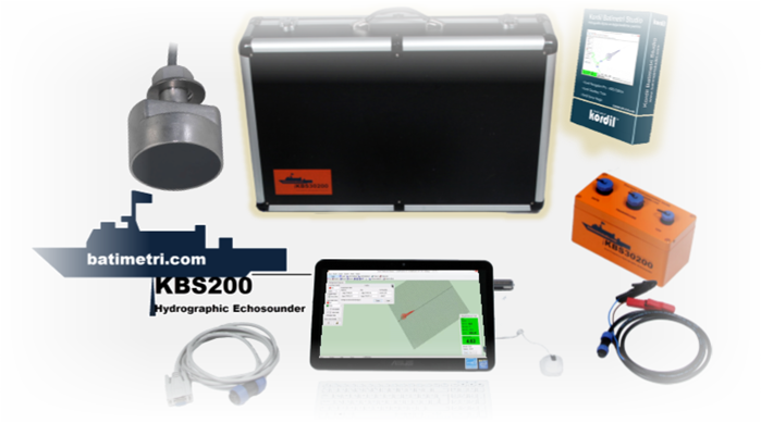
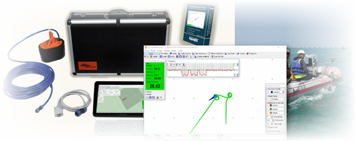
Kordil Bathymetry Studio 200 (KBS200) Singlebeam Echosounder System was developed by Kordil and is a low cost singlebeam echosounder system, all in one package with a complete hardware and software and universal mounting frames and apparatus. The system is fully packaged inside a robust and durable transit case including mounting poles and bolt to mount GNSS antenna. System is designed to work depth from 0-100 meters. The case has space for any other tools (GNSS, hand tools etc.) require for a perfect singlebeam bathymetric survey which makes self check-listed bathymetry gear for surveyors.
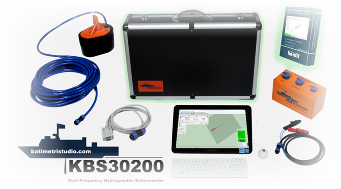
Kordil Bathymetry Studio 30200 (KBS30200)
Singlebeam Echosounder System is Kordil's proprietary dual frequency singlebeam echosounder developed by Kordil and is a low cost dual frequency singlebeam echosounder system package, all in one with a complete hardware and software including universal mounting frames and apparatus. The system is fully packaged inside a robust and durable transit case including mounting poles and bolt to mount GNSS antenna. System is designed to work depth from 0-300 meters. The case has space for any other tools (GNSS, hand tools etc.) require for a perfect singlebeam bathymetric survey which makes self check-listed bathymetry gear for surveyors.
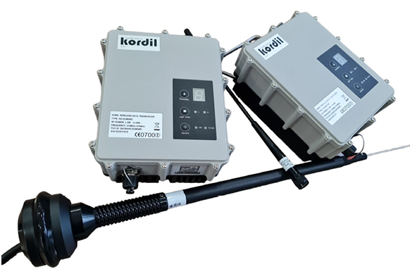
Kordil UHF35 Radio modem, solution for critical applications requiring stability, top‐notch performance, and extensive range. This high‐speed, high‐power wireless data link is engineered to withstand the demands of GNSS/RTK surveying and precise positioning tasks. With 35 Watt of power, it ensures
exceptional range even in challenging urban environments.
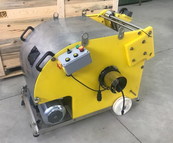
One man transportable wheeled winch system
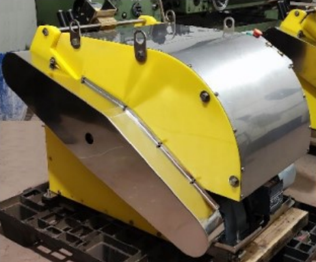
Specially designed and manufactured for subsea surveying and mapping projects. It works with high precision for measurements with the mechanical and optional digital counter on the crane. Easy to install and use. Practically portable and one man operation. It helps you make your projects more effective for marine mapping, research, exploration and more.
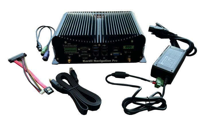
Kordil Fanless Industrial Mini PC, is a compact computer system designed to operate reliably in harsh conditions such as extreme temperatures, water, dust, moisture, and vibration, which are common in industrial settings. This system has been extensively in use trouble free for similar applications including extremely large seismic vessels to small rubber boats.
This GNSS PC offers superior features, delivering identical or even better precision compared to industry-standard GNSS systems.