Kordil
Kordil Geodesy Tools (KGT)

Kordil Geodesy Tools (KGT)
Kordil Geodesy Tools (KGT) is a powerful and reliable coordinates processing, transformation, and transformation parameters estimation software for surveyors. Easy to use interface and intelligent file reading makes it a handy tool for the surveyors.
KGT Tools
- Earth Centered Earth Fixed (World Cartezien) Coordinate System Transformation
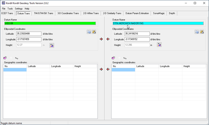
- Datum Transformation
- Transverse Mercator / Universal Transverse Mercator / Gauss Kruger Projection
- 3-D Coordinate Frame Transformation using 7 parameters
- 2-D Affine Transformation, and parameters estimation (6 parameters)
- 2-D Similarity Transformation and parameter estimation (4 parameters)
- 3-D Datum Transformation Parameters' estimation (7 parameters)
- Image map georeferencing, displaying, editing and saving
Features
- Intelligent recognition of various coordinates types in files
- Once the file is uploaded, it can be viewed on the screen in table cells
- Direct transformation from one datum to another versus WGS-84 datum
- Datum definitions through database and manual input window
- Toggling through deg, deg-min, and dec-min-sec
- Setting output precision for both file and manual conversions
- SonarMagic: Combine time stamp location data and sensor data with millisecond accuracy.
- Filter: extract a certain message contained in the content of an ASCII message
Trial Version
Program is installed with Kordil Batimetri Studio
