Magnetometer
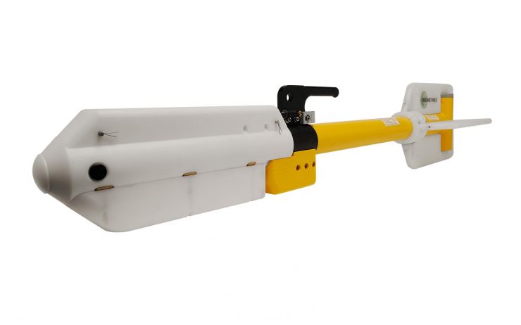
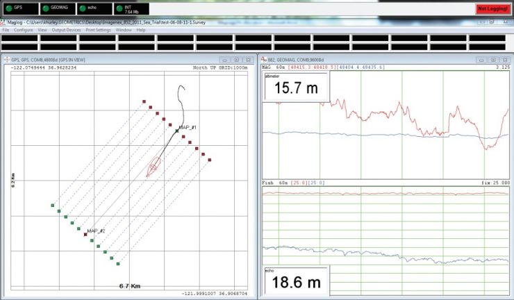
For magnetometer research, we use a very high resolution cesium marine magnetometer, which is recognized as the leader in the field. Kordil uses magnetometers capable of scanning large areas for shorter periods with high performance and high speed measuring capability (up to 20 Hz). The magnetic measurements are integrated with high precision GNSS data and positions of magnetic anomalies were calculated to provide information about the anomaly in depth, size and mass. We use advanced software to record, process, and map magnetic location data via GPS. After data processing, we create magnetic field maps by reliably modeling magnetic data. According to their magnetism properties (in proportion of ore properties and masses), these objects cause different rates of change in the total component of the magnetic field. These differences are called "anomalies" in maps. We provide technical reports on the maps by determining the targets with anomalies and calculating the depth, size and approximate masses.
We are ready to look for a screwdriver up to a transatlantic shipwreck located on or below the seabed.
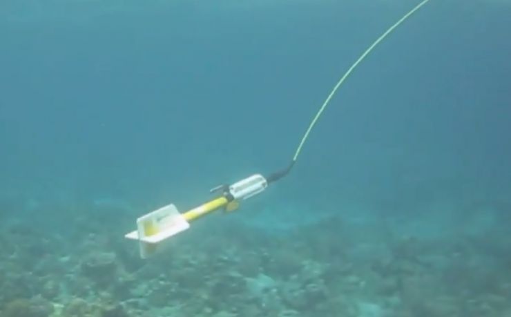
Surveying with Marine Magnetometer
Kordil has Cesium marine magnetometer in its inventory which is small in size and offers a variety of flexibility for professional research in shallow or deep waters down to 2500 m. As it is small and light, it is easily deployed and operated by one person. By adding a few hydrodynamic weight rings, the system can be made heavier than 45 kg quickly to take measurements in deep water. In addition, magnetometers do not send any rays or signals into the ground. For this reason, they are called passive devices. It can be towed behind a side scan sonar or alone on ROV, on towing cable.
The magnetometer not only can detect a large tonnage ships buried under the sea floor or under the seabed, but it can also detect a screwdriver length of 10 cm.
Pipeline Detection
We carry out the research for cable, power transmission lines, pipeline, and deep sea discharge lines and locate existing crossing third party lines.
Search for Ship & Plane Wrecks
Detection of shipwrecks or wrecks out of airplane crashes into the sea. The magnetic survey is one of the fastest way to detect wrecks in short period of time.
Route Clearance
Kordil performs route clearance surveys for pipelines, cable lines to avoid no sunken obstacles existed on the route which can damage the line. There are always possibility for existence of unwanted objects which may not be visible in high resolution multibeam, high resolution side scan sonar surveys and subbottom surveys. All have limitations to detect a buried ship anchor, but magneotmeter can detect and locate it.
Research for Unexploded Ordnance (UXO)
Like North Sea, Persian Gulf, Canakkale Strike, where war happened, there is always possibility to have unexploded ordnance which can be indeed harmful for the construction if exploded. Some of them remained well protected and isolated under the seabed, and still protects their shape and housing. Prior to performing any construction activity in such proximity, UXO research is always recommended.
Detecting Ferrous Objects of Any Kind
We detect all kinds of metal objects such as valuable equipment, tools, anchors, and chains that disappear by falling into the sea in offshore works. Contact us when you have incidents like that.
Geological Analysis and Environmental Research
As an alternative method, magnetic surveys can be used for interpretation of geomorphology of seabed spread over a large area.