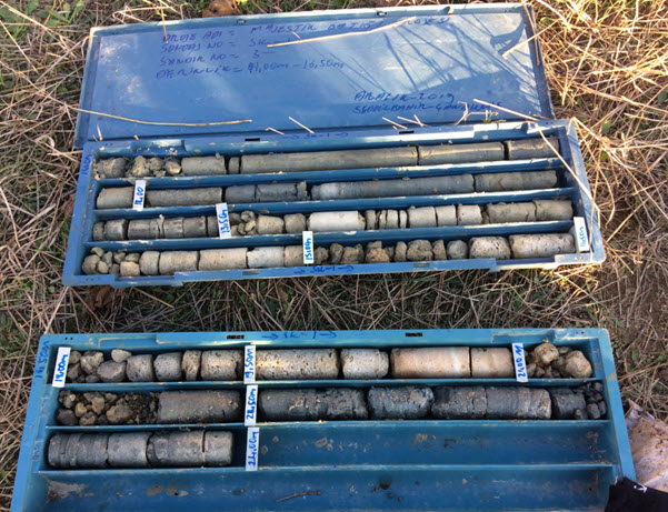
Boring & Sampling and Geological Analysis
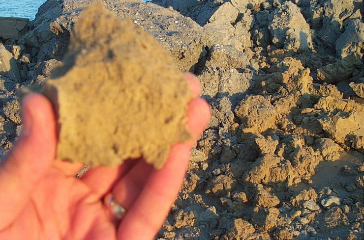
We are performing drilling or sampling studies for general geology, and seabed classification based on various laboratory and visual tests. For this purpose, we use industry standard coring techniques, gravity corer, and occasionally Vibro corer at 0-1000 meter depts. The samples were analyzed in qualified laboratories and examined and reported.
The coring samples are usually used for engineering design, calibrating the velocity of seismic data, locating the thickness of layers, and also verification and interpretation of strata thickness. Combining the geological information with geophysical data together, Kordil obtains very reliable subbottom data which can be used for any engineering design that is reliable and trustable.
Sediment Sampling
Kordil in general utilizes gravity corer or Van Veen Grabber for sediment sampling. The grabber is used by hand and is usually implemented in coastal and surf zones, whereas the gravity core is used in deeper areas to take samples from the ground. Samples are taken from different places to cover the examination area according to the purpose of the study. With these samples, we create a sediment distribution map that represents the sea floor. We make engineering calculations with the data obtained from the experiments performed in the laboratory environment according to the type of samples taken. We turn all the results into a report that reveals the ground features.
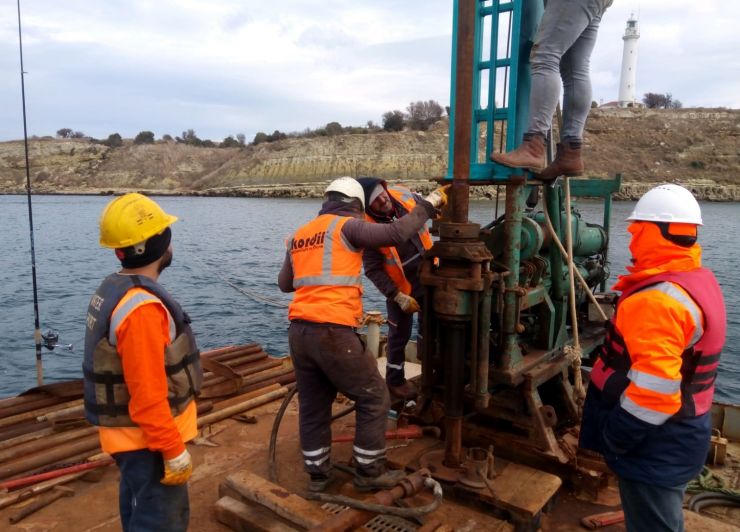
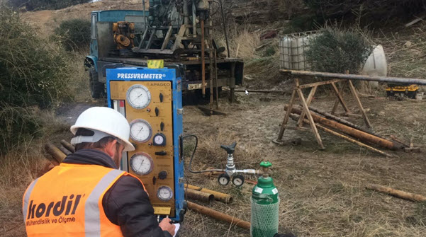
Boring
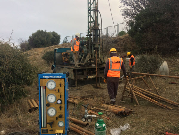
We have the capacity of drilling on land and at sea with drilling machines and equipment mounted on trucks on land and mounted on pontoons at sea. During drilling, we conduct field tests such as SPT, CPT and presometer tests and take samples under the floor. The experiment and sampling process is repeated at several different levels depending on the purpose of the study. We make engineering calculations with the data obtained from experiments performed in the laboratory environment according to the type of samples. We present all the results in a technical report that demonstrates the ground properties.
Seabed Geomorphology
In order to reveal the properties of the existing base topography and determine its formation and change, we conduct marine soundings and sediment sampling.
Geotechnical Studies for Coastal & Offshore Structures
Defining the subbottom profile at the planning stage of engineering structures such as ports, jetties, deep sea discharge lines, fishermen shelters, geotechnical risks such as soil bearing capacity, settlement investigation, bedding coefficient, groundwater condition, excavation slope stability, excavability, drainage measures, and liquefaction. Also, the comparison of the static values of the existing structures with the required ground parameters.
Determination of Excavation and Backfill Method
Kordil performs studies for determination of excavation and backfilling methods during construction of breakwaters, barriers, and backfill areas in terms of soil stability. Defining type and resistance of existing seabed is very essential to be determined before placing a major load on top of it. There are incidents happening every year by walk off barriers and breakwater due to missing seabed information or proper engineering design.
Determination of Piling Method, Pile Length and Type
Kordil performs geological studies to assist engineering design to determine length and type of piles to be stubbed into the ground for offshore construction. The geological studies were always supported with geophysical information and best reliable solutions were obtained.