Photogrammetry Engineering
We are adopting nonsettled yet modern technology to our professional occupation with extreme care and well-tested and well-resulted projects. The recent development of drone photogrammetry made it challenging for various traditional applications as well as opened new business opportunities at low costs such as 3D modeling of an industrial object or a terrain.
Kordil's past experience in aerial photogrammetry evolved into challenging drone photogrammetry where there are many kinds of problems made much easier to handle at a very high speed and reliable in resulting. Within the scope of photogrammetric map and orthophoto production, we have carried out large and small photogrammetric projects in many cities such as Muğla, İstanbul, İzmir, Kırklareli, Rize, Ordu, Edirne, Samsun, Isparta, Eskişehir. Some of our staff took part in every stage of the Istanbul, Izmir Metropolitan Area, and Istanbul Water Basins Photogrammetric Mapping (EMI Map, 1995-1998) projects, one of the biggest projects of its time. Within the scope of the project, photogrammetric maps of Istanbul and Izmir cities were produced and updated with digital methods. In these projects, orthophotos of a total area of 1400 km2 for Istanbul and 380 km2 for İzmir were produced with 1/1000 scaled photogrammetric maps in a total of approximately 10000 sheets. The maps obtained from this project provide the basics of today's Istanbul City Information System.
Photogrammetry Services
Kordil has carried photogrammetry engineering to another level. We apply photogrammetry in every area, from a few mm-sized objects to thousands of hectares of areas.
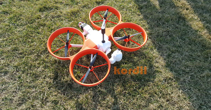
- UAV (drone) photogrammetry
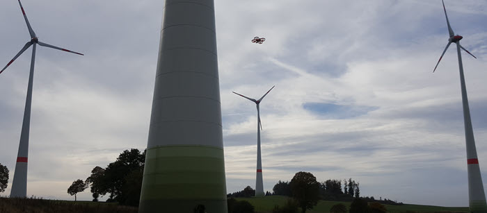
- Modeling wind turbines, buildings, cliffs, historical monuments and similar structures
- Topographic mapping of routes (such as road, pipeline, and railway)
- Deformation analysis
- Point cloud generation and 3D image modeling
- Photogrammetric restitution and mapping
- Flight planning, aerial photography and aerial triangulation
- Mapping, orthophoto, topographic plan and digital terrain model production
- City, street and building modeling
- Object modeling and as-built (creating 3D models of objects)
- Micro photogrammetry (creation of microscopic objects and models of living spatial)
Terrestrial Photogrammetry & Close Range Photogrammetry
In order to protection of historical monuments and clone exact copies, we generate photogrammetric models by close range photogrammetry. Similarly, we perform integrated studies with drone, terrestrial and geodetic surveys of historical sites for the registration of ancient artifacts, streets, and for the protection of cultural heritage.
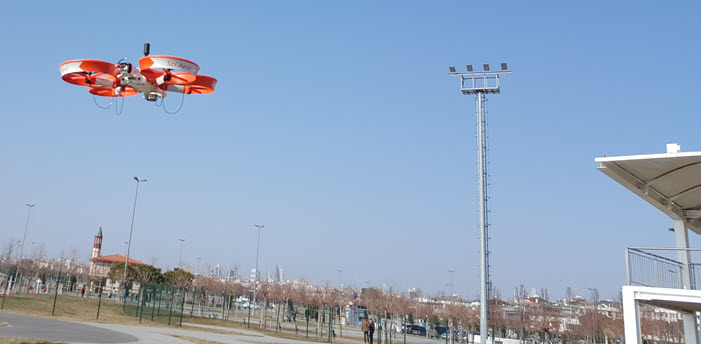
Drone Photogrammetry
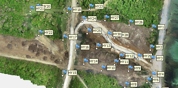
Kordil produces photogrammetric maps with very high accuracy by using the UAV systems on its own and distributes drones to local survey market. Some of these maps are also used as a base in huge international projects. These surveys were accepted to be in survey and basement of volume calculations, and closeout surveys supported with high resolution orthophoto.
Aerial Triangulation
Kordil performs aerial triangulations to orient and restitute aerial photogrammetry and generate control points and tie points, and performs bundle adjustment of an entire block.
Photoplan
Single photos without stereo images are subjected to two-dimensional affine transformation to obtain best feasible georeferenced photogrammetric image. Kordil produces photo plans from old aerial photographs, which will provide the basis for the case files like property violations by using old or historical pictures. If it requires high accuracy, it can be presented in the form of a fully compatible map using a stereo plotter or image processing techniques.
Similarly, for the rectification and coordination of satellite photos, the objects on the photo are coordinated and make photo plan maps very close to the actual. These types of maps have widespread use for the identification of tree shadows in agricultural areas and for general planning purposes. Photo plans work best for flat lands where minimum high and land spots are available.
Subsea Photogrammetry
Kordil performs subsea photogrammetry using underwater cameras and videos to generate 3D model of subsea objects on the seabed. By utilizing underwater camera systems to measure object photogrammetric methods and generates great imaging of the underwater objects using nonmetric, non-expensive camera and visualization system.
Orthoimage / Orthophoto
We produce true orthophotos (also called orthoimage) with georeferenced and suitable for GIS applications and vector and raster overlay. Depending on requirements, we use true orthophoto of bridges buildings and other rising or above ground objects to get proper coordinates systems of ground as well as artificial objects.
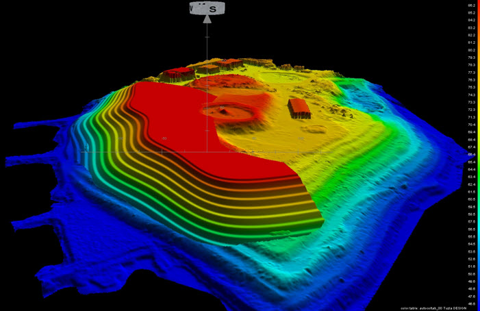
Digital Terrain Model / 3D Modelling
We create a digital terrain model by using a high-resolution metric and amateur cameras calibrated as well as 3d modeling of any object which has sufficient surface fadedness to take good pictures from (class covered buildings may not be suitable). Examples of those, are buildings, historical places, rocklands, breakwaters, coastal lines, plants, ships, and similar objects.