
Datumate
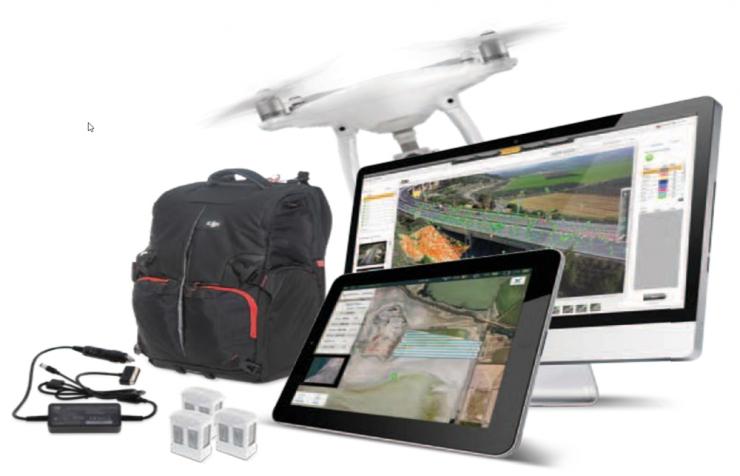
DJI-Datumate Photorgrametric Site Survey Solution is a comprehensive and professional package of imagery and mapping tools that help surveying, construction, inspection and infrastructure companies quickly generate a working model, site visualization, analytics and plan. The solutions consist of DatuFly™ app which generates a flight and image-taking plan for DJI drones and Datumate’s photogrammetry software that converts aerial and ground images to high-precision, geo-referenced 2D maps and 3D models with detailed site visualization.