
Datumate
DJI - Datumate
DJI - Datumate
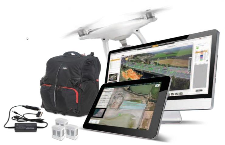
DJI-Datumate Site Survey Solution is a comprehensive and professional package of imagery and mapping tools that help surveying, construction, inspection and infrastructure companies quickly generate a working model, site visualization, analytics and plan. The solutions consist of DatuFly™ app which generates a flight and image-taking plan for DJI drones and Datumate’s photogrammetry software that converts aerial and ground images to high-precision, geo-referenced 2D maps and 3D models with detailed site visualization and analytics.
System Components
DJI Phantom 4 + RTK Drone
DJI Phantom 4 is a compact, high quality quadrotor camera drone that can be easily carried everywhere. With flight duration of 28 minutes per battery and a speed up to 40mph, the phantom 4 covers a large area in a short period of time. Utilizing Active Obstacle Avoidance, the Phantom 4 can actively react and avoid obstacles in its path. Image geo tagging allows for a more reliable image linkage.
DatuFly Professional Imagery App
DatuFly is a tablet app for easy flight planning and automated, high resolution photo-shooting of a surveyed object or area. With job type optimization and autonomous flight and photo-shooting, DatuFly is ideal for professional surveying applications. Image-Taking plan is executed based on the best practice requirements of DatuSurvey, Datumate’s comprehensive field to plan software.
DatuSUrvey, Intuitive Field-to-Plan Software
DatuSurvey is a comprehensive, civil engineering field-to-plan software that automates surveyors’ office work. DatuSurvey turns drone and camera based images to accurate, georeferenced 2D maps and 3D models, saving the need for expensive and risky fiend work and accelerating results
System Key Features
- Fully automated, End-to-End Field-to-Plan solution
- Intuitive and simple operation
- Safe operation with drone safety checks and Active Obstacle Avoidance
- Extended battery life and high-speed flight drone
- The quickest route to a working model
- Tailored for professional surveying jobs, survey grade accuracy