Kordil
Kordil MetOcean

Kordil MetOcean: Meteorological and Oceanographic Measurement Station
Meteorological and oceanographic measurements are combined on integrated platforms to obtain multiple data from a single point. For this reason, it was named Metocean. The Kordil Metocean system brings a high-level oceanographic system and a high-level meteorological system together on a single platform which enables to combine, record and sent to a remote location in real time at desired intervals. This platform can be anywhere including a buoy at the middle of ocean, at your ship roof or work site.
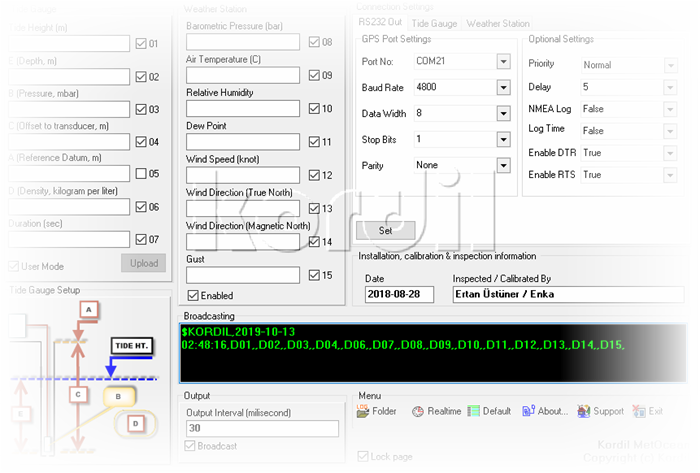
Kordil MetOcean software with user friendly interface is a Windows-based program, which allows easy data transfer to remote locations.
Applications
- Offshore Construction Projects
- Petro-chemical Industry and oil rigs
- Long term observation stations
- Harbour and Shipyard safety
- Determination of occupational safety risk criteria
- Determination of design and design criteria
Features
- Water temperature
- WindSpeed
- Wind Direction
- Air Temperature
- Relative humidity
- Wave Height
- Wave Direction
Brochures
- English Brochure
- Turkish Brochure
