
MiniPod GNSS
MiniPod GNSS
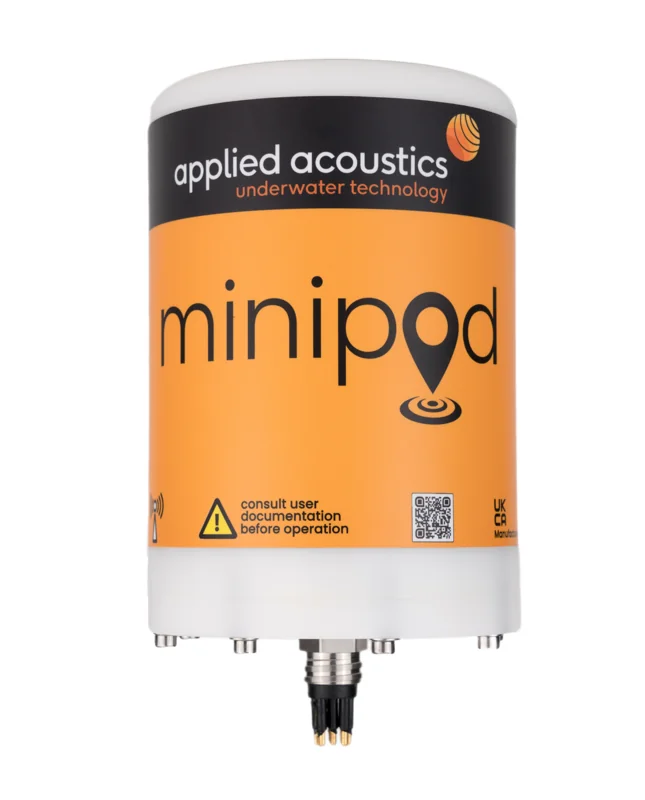
Applied Acoustics MiniPod is a configurable GNSS range designed for marine survey equipment that may be exposed to spray, repeated immersion or subsea deployment. It supports surface positioning of seismic sources, streamer heads and tails, towed sensor arrays and marine vehicles. The receiver, housing, connectors and telemetry arrangement can be selected to match the intended platform and survey workflow.
Surface positioning with submersible protection
The term submersible describes the protection and survival capability of the selected housing. GNSS reception requires an antenna with a suitable view of the sky; MiniPod does not provide a satellite position fix while submerged. For equipment that operates below the surface, surface GNSS positioning can form part of a wider navigation solution alongside acoustic tracking or other sensors.
GNSS receivers and correction options
The supplied range includes Hemisphere and Septentrio receiver options. Depending on configuration, correction choices include PPP L-band services using Atlas or Fugro Marinestar, RTK operation as a base, rover or moving base, and RTCM v3 data. The choice depends on the required positioning performance, correction availability and the connections provided by the survey system.
Housing and environmental options
The MiniPod family includes protection options from IP67 through housings rated for 6,000 m submersion. Options also include shock ratings up to 75 G and extended temperature capability. These are configuration choices across the range; they should not be assumed to apply to every MiniPod model. The intended mounting, immersion depth and environmental exposure should be defined before selecting a unit.
Telemetry and interfaces
Wireless data arrangements can use internal or external antennas, with stated range options of 600–2,000 m depending on the selected equipment and conditions. Eight-way and sixteen-way connector arrangements offer combinations of RS-232, RS-485 and PPS. A compatible receiver and power arrangement complete the installation.
Marine survey applications
Typical uses include seismic source positioning, streamer head and tail positioning, surface tracking of ROVs, AUVs, USVs and trenchers, and towed-array operations. Kordil can help define receiver, correction, interface and housing requirements so the MiniPod installation works with the wider survey equipment.
MiniPod model specifications
| Feature | 201G / 203G | 202G / 204G |
|---|---|---|
| GNSS arrangement | Single antenna positioning | Dual antenna positioning and heading |
| Submersion rating | 201G: 50 m; 203G: 1,000 m | 202G: 50 m; 204G: 1,000 m |
| Standard RF range | 600 m, directional | 300 m, omnidirectional |
| External RF option | Up to 2,000 m; IP67 antenna | 202G: up to 2,000 m; not available on 204G |
| Interface options | 8-way or 16-way serial connector | 16-way connector; optional INS/AHRS on A variants |
The 201G and 203G support L1, L2 and L5 signals with 544 receiver channels. Their specified RTK accuracy is 0.6 cm + 0.5 ppm horizontally and 1 cm + 1 ppm vertically under the stated operating conditions. Supply requirements are 12–26 V DC, 24 W. The 201G measures 115 mm in diameter by 170 mm and weighs 1.95 kg; the 203G measures 125 mm by 218 mm and weighs 2.5 kg. Shock rating is 75 G.
For heading-sensitive towing applications, the dual-antenna 202G or 204G provides an alternative to a positioning-only installation. Select the model by immersion rating, mounting space, required heading output and radio path; radio range is not a subsea GNSS operating range.