
NORBIT iWBMS
NORBIT iWBMS
An integrated bathymetric survey system combining wideband sonar with Applanix WaveMaster II GNSS/INS. The compact package reduces separate sensor installation work and supports rapid mobilisation for harbour, river, lake and coastal mapping, with roll stabilisation and backscatter recording.
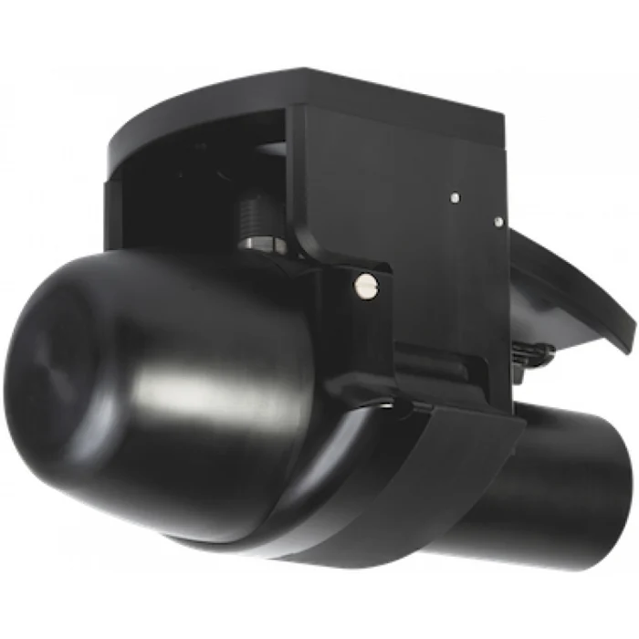
Integrated GNSS/INS for survey mobilisation
iWBMS combines WaveMaster II navigation and broadband sonar in an integrated survey package. Harbour, river, lake and coastal bathymetry benefit from reduced mechanical integration of separate sensors. The standard 1.9° along-track beam and the Narrow Beam option address different feature-resolution requirements. NORBIT lists iWBMS under Legacy products in its download catalogue; hardware and software options should be considered against the relevant brochure revision.
Applications and survey workflow
Bathymetric data supports harbour maintenance, dredging assessment, route surveys and the inspection of submerged infrastructure. Survey line spacing and frequency are selected to balance feature definition, coverage and the expected water depth.
Before mobilisation, the survey team defines the coordinate system, vertical reference and required deliverables. Mounting geometry, sensor offsets and time synchronisation are checked as one installation. Positioning quality, vessel motion and sound-speed conditions are reviewed during acquisition so that the final dataset can be assessed against the project specification.
Integration and deliverables
The selected hardware and software configuration determines the available outputs and interfaces. A practical workflow includes installation checks, a trial line, field quality control and documented processing. Depending on the sensor, deliverables may include a bathymetric surface, an inspection image, a point cloud or an interpreted sediment profile. Kordil can evaluate the platform, operating environment and intended use when defining the system configuration.
Technical specifications
| GNSS/INS | Applanix WaveMaster II |
|---|---|
| Frequency | 400 kHz nominal; 200–700 kHz |
| Swath sector | 5–210° |
| Ping rate | Up to 60 Hz |
| Housing depth rating | 100 m |
| Interface | Ethernet |
| Acoustic depth range | 0.2–275 m; with the narrow-beam option >300 m |
| Beam width @ 400 kHz | 0.9° × 1.9° standard; 0.9° × 0.9° narrow-beam option |
| Range resolution | <10 mm; 80 kHz bandwidth |
| Roll / pitch accuracy | 0.02° |
| Heading accuracy | 0.03° RTK; 2 m antenna separation |
| Power | 60 W |
Specifications follow the original manufacturer brochure PS-120006-24. Acoustic range is distinct from housing depth rating. Options and operating conditions affect achievable performance.
Technical brochure
NORBIT iWBMS original technical brochure — English PDF (PS-120006-24)