
NORBIT
Norbit iLIDAR
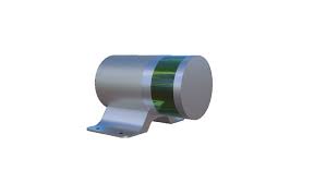
Norbit Turnkey Mobile LiDAR System for Complete Above Water 3D Point Cloud
NORBIT iLiDAR is the most compact terrestrial mapping sensor fully integrated with a high resolution bathymetric multibeam system. Performing multiple missions simultaneously, topographic and hydrographic data collection at the same time. With 300k data points per second in 30°x360° coverage it is an ideal tool for mapping above water surface terrain for a complete picture from a single pass. A robust single cable connects the IP67 iLiDAR sensor head to the topside Sonar Interface Unit (SIU) – with fewer connections, rapid integration and compact size. NORBIT’s iLiDAR laser sensor is an all-new multi-sensing concept that combines multiple tightly integrated sensors into one hardware platform with a single LAN connection to survey laptop.
iLidar Laser Sensor Technical Spesifications
- Infrared Laser Module: 1-20 Hz time of flight measurements with dual returns
- Frame Rate: 5-20 Hz
- Wavelength Peak: 905 nm
- Output: 300.000 points per second
- Angular Resolution: Horizontal: 2° between each of the 16 lasers, Vertical 0.1°-0.4°
- Field of View: 30° Vertical, 360° Horizontal
- Range: 100 m
- Accuracy: 2 cm
- Power Consumption: 8W
Features
- Built for Marine Environment
- Fully Integrated With iWBMS
- Single Cable Integration
- Less than 3 Kg